|
|
Gold
Mining in Southern
Oregon For
the Spectator.
Editor Spectator--Sir:
For some time past I have sought an opportunity to redeem my engagement
of writing to you and giving as correct an account of these "diggins"
as possible, for the benefit of your readers. My apology for this long
delay is simply that, on my arrival here, I was necessarily much longer
in getting located and fixed for digging than I expected to be. An
account of a miner's life &c. is unnecessary in this letter,
for
the reason that but a very few of the Oregonians are uninformed upon
that point, not only by reading, but they have personal experience of
the matter, and those who have not will very readily obtain oral
descriptions of it, which cannot but be much more satisfactory and
vivid. The mining on this river at present consists almost entirely of
working the bed of the river; a few, however, are still working in the
banks.
Before any of the dams were ready to take out gold, great hopes were entertained, and nearly all were confident of a liberal and even a large return for their time, expense and labor. These dams are worked by companies of miners, the company varying in number from 8 to 20 or more. A system of speculation was tolerated by the miners here, which, I understand, was not suffered to exist in Lower California, at least when those mines were as new as these. It seems that those who were somewhat in advance of the rush for this river immediately, each for himself, laid claim to a sufficient portion of the bed of the river for from 10 to 20 men to work out in one season, and then, when the working miners came, sold to them shares, the number being according to the length of their claim, asking from $100 to $400 per share, and thereby in many cases making moderate fortunes without a stroke by fleecing from the hard-working miner his honestly obtained and hard-earned gold. A more wholesale imposition upon the industrious miner I never heard of, and am only surprised that such a system of robbery should have been for a moment tolerated or gained the foothold it has. In a majority of cases, however, the condition of the payment was made to be that the purchase money was first to be taken out of the claim, and drawn by the shareholder from the treasurer as the income for his share. The fact of very many of these dams failing in whole, or in part, has very much disappointed the undeserving and in many cases dishonest speculator, and nipped his golden dreams in the bud. I am of the opinion, however, that Scott River--that portion of it which is being worked--is as rich as perhaps any river that up to this time has been worked in California. I may be wrong in this, as my knowledge of Lower California has been obtained from others altogether. Some of the dams are very rich--some pay from $20 to $40 per day--and others from ½ to an ounce per day, while very many will hardly pay for working, and a good many [are] already abandoned, the two last, perhaps, embracing the larger number. The old Goodwin, at present called the Lafayette Damming Company, took out the other day something over $8000, not using the entire day either--as I understand they were moving timbers or something else a small portion of the day. These latter things, however, are always necessary to carrying on the works and must be done. They by no means average the above amount, but the claim is very rich, and those engaged (22 in number) will make a good "raise." If it had not been for a lawsuit with certain other claimants, which cost the company some $3000 or $4000, they would have done something better still. All the dams are troubled very much with leakage water, to a greater or lesser extent, according to the depth of their diggings, which causes much expense and labor to remove. Pumps of different kinds are in use with various success. The Lafayette Company are using a pump propelled by water, the pump consisting of a tight box of the required length, and about 13 inches by 6, one end submerged in the water about 1 or ½ feet. Strong canvas is then prepared of equal width with the box or pump, and the two ends sewed together, two rollers of same width as the pump are fastened one at each end, upon which the canvas rolls. Upon this cloth, at a distance of 16 or 18 inches apart, are fastened blocks, nicely fitting the pump, and when put in motion, the blocks finding water in the lower end of the pump, force it up until it empties itself out of the top, and then runs off in any manner the person desires. This company have two of these pumps, and they are answering a very good purpose. The best and by far the fastest pump I have seen on the river is worked by water power on the "Gipsey" claim, about two miles below Scotts Bar. It is a screw pump, and probably the principle is familiar to most of your readers. This pump was constructed at great expense (some $1200) by Frederick Derrick, the enterprising foreman of the company (at the mutual expense of the company, however). Mr. Derrick is from Rockford, Ill., and some time since in the employ of the N. American Fur Company, and while in their employ builder of Fort Laramie. For his great ingenuity and perseverance in the construction of this pump (which throws the enormous amount of a barrel of water a second), and that too without any of the conveniences of lumber, ready sawed, and with a very poor and scanty supply of tools he receives, and is deserving of, the highest praise and commendation. The gold taken from this river is of the very best quality, and mostly coarse. A short time since, there was taken from the Little Company, the first above the Lafayette, and opposite the town, a solid piece of gold weighing 10 lbs. avoirdupois. I would here caution the reader unacquainted with mining against forming too favorable an opinion of them, and bear in mind that while one man is so fortunate as to find diggings of this description, perhaps 500 may be with some difficulty making even moderate wages, and perhaps half this number hardly paying expenses. It is at present rather a dull time here; those miners whose dams have failed have mostly left for the mountains to hunt winter diggings. It is very confidently expected that rich mines will be found in some of the gulches leading into Scott River. I am myself inclined to that opinion, but do not think they will be found until water comes, at least not to any extent. At this time there is probably three or four hundred miners in the mountains about this river and the Shasta diggings. It is rumored that some small parties have found very rich mines somewhere around here, and I do not credit the tale. [Those stories may have been about the discovery of the Althouse diggings in Josephine County.] It is rather amusing to see the pertinacity with which some entertain this belief. If they see a party of half a dozen or so traveling by themselves, with any appearance of having supplies with them, some who are on the watch will immediately set out and follow them, and the party followed all the time upon the same errand as themselves. I verily believe I could take my horse, and start out at evening with a little manifestation of a desire to be alone, and get a hundred men to dog my steps upon and over some of the most awful mountains ever traversed by a mule! The miners about Shasta are doing very little at present, but the city is being built up very fast, and is already quite a town. Confident anticipations are entertained of doing well about there when the rains set in--I think they will. Supplies are plenty in this country and cheap; flour about 30¢ per lb.; beef 25 to 30¢ lb. on this river, and at Shasta 20 to 25¢ per lb.; potatoes 50¢ per bushel; onions 60¢; clothing plenty and reasonable. The Indians appear to be friendly at present, and we all hope that no difficulty will occur. If you are acquainted with an upholsterer in Oregon who is desirous of going into the manufacture of mattresses, just send him out here; he will find plenty of hair, some curled and some not--he can make his fortune! The Oregonians must not depend too much upon receipts of gold dust from these mines to make trade lively this winter, for the larger portion of it goes and will go to California. I occasionally see a Spectator here, and would like to see them much oftener. We are compelled to lead a kind hermit's life here, which to those accustomed to living in old settled countries where news is plenty, and received by lightning, is at first rather dull and tedious--but as I have made my bed, so will I lie on it. Yours,
Oregon
Spectator, Oregon
City, October 21, 1851, page 2PICK AXE. Personal Experience in Quartz
Mining.
The Jacksonville (S.O.) Sentinel,
commenting
upon a recent quartz mania that appears to have broken out about Yreka,
supplies the following result of personal experience to the common
stock of information on quartz mining in the state. It may be found
useful to dabblers in quartz elsewhere:
"We have bought some experience in quartz, and paid rather liberally for it too. But it was when this species of mining was in its infancy in California, and wiser and more scientific heads than ours showed conclusively in theory that to engage in it was but another name for coining money, where the precious metal was furnished free of cost. Stern, uncompromising practice, however, developed that the coining operation was simply reversed. It was no more than furnishing to others the money already coined without any other return than that costliest of all human lessons--experience. Since then we have paid more attention to quartz and its queer freaks, and as attention was about all we could pay, we received at least the benefit of better knowledge of everything pertaining to it as compensation for the time bestowed. Therefore, we now profess to know something about our subject, and without going into a lengthy dissertation, will give the result of experience upon a leading characteristic of gold quartz. "An almost infallible rule to be observed in quartz veins is to quickly abandon those leads which 'crop out' most abundantly, as the gold is rarely, if ever, found to reach much below the surface earth in them. It is not the richest veins which reveal to the eye the most gold and a continuous yield of the shining metal. The most lucrative quartz mines in California are those which prospected poorly at first, and in which 'the color' was not visible to the eye in any of the surface rock. To test the quartz fairly it is necessary to get out tons of it first, and then submit pieces taken here and there along the depth of the shaft to skillful assay. If the gold is found more plentiful with increasing depth, there is little risk in going to the expense of adequate machinery to work the mine. But if the yield diminishes from the top until a few feet down, that vein will only result profitably by doing with it as Brigham Young did with the troops--letting it 'severely alone.' Those who chance to own a good-paying vein, and are too pinched in circumstances to afford the outlay for a steam engine, etc., can manage very well with the ordinary Mexican arrastra until their earnings enable them to purchase more costly and powerful machinery, provided their claim promises sufficiently exhaustless to warrant such application and expenditure. But it is quite invariably a suicidal and ruinous enterprise to become involved in a debt for these appliances at the outset, with nothing more substantial than a 'good sight' to provide for after payment "We offer these remarks at this time because recently there has been a good deal of gold-bearing quartz picked up about our own county, and some in Josephine (Southern Oregon), and already parties are out prospecting for leads. The specimens exhibited are of what we might call a healthy richness; that is, they are not profuse with great flakes and veins of gold, but rather indicate that the best is yet to come from far below. Where these are found there are undoubtedly extensive leads of surpassing and exhaustless yield, nor can they long remain undiscovered, with the energetic efforts that are being daily made to find them. From what we have seen of the region, we are profoundly convinced that there is an abundance of handsomely paying gold quartz to be found in it, and this is sufficiently evident from the discoveries recently made." San Francisco Bulletin, November 3, 1859, page 1 JACKSON COUNTY
I am
indebted for much valuable
information concerning this county to Mr. Silas J. Day, of
Jacksonville, whose character and long acquaintance with the
neighborhood give ground for confidence in the correctness of his
statements, many of which are also confirmed by my personal observation.The population of the county is about six thousand six hundred, of whom six hundred are Chinese, principally engaged in mining. The number of white miners, according to the books of the county assessor, is five hundred. The latter receive, when hired, from $2.50 to $3 coin per day. The wages of a Chinese laborer are $1.25 to $1.50 per day, or $35 per month. The following is a brief account of the principal mining districts in the county: Jacksonville district, including both forks of Jackson Creek and its tributaries, was organized in 1851. The mines hitherto worked have been placers, with some coarse gold. Applegate Creek, ten miles in a southerly direction from Jacksonville, is a considerable stream, on which a sawmill has been erected. It is a tributary of Rogue River. The district of this name was organized in 1853. The mining operations on Applegate Creek have been quite extensive. The gold is found mainly on the “bars” of the creek, which for a distance of four miles were very rich. They are now principally worked by Chinese. Water is obtained from a large ditch brought from the creek four miles above the bars, and now owned by Kaspar Kubli. Sterlingville district, about eight miles due south from Jacksonville, was organized in 1851. This has been, and is still, a thriving mining camp. The gold in the placers is coarse. The supply of water, however, is limited, as there is no ditch in the district which taps any considerable stream. Bunkum district, on the other hand, a southern extension of Sterlingville district, has an abundant supply of water during most of the year, brought in three ditches from the North Fork of Applegate Creek. Foots Creek district was organized in 1853. The stream from which it takes its name is a tributary of Rogue River, situated about fifteen miles northwest from Jacksonville. The mines are coarse gold diggings. Evans Creek and Pleasant Creek districts are contiguous to each other, about ten miles north of Foots Creek. The coarse gold diggings of these districts are worked principally by the hydraulic process, for which the necessary supply of water is furnished by the streams named in abundance during the rainy season. Both these districts were organized in 1856. Forty-Nine Diggings, eight miles southeast from Jacksonville; organized in 1858. The gold is inferior in quality, and worth only about $12 per ounce. Water is supplied by a ditch from Anderson and Wagner creeks. The mining laws of all these districts are copied from those of Yreka, in California. The tax on foreign miners (by which only the Chinese are understood) is $10 annually per capita. There is also an annual poll tax of $5 on all mulattoes, Chinamen, and negroes. The first discovery of gold in Jackson County is said to have been made in the autumn of 1852, by James Clugage, on Rich Gulch, a tributary of Jackson Creek. Both in the gulch and in the creek large nuggets were, in the earlier days of the mining industry of this neighborhood, frequently found. One piece of solid gold, worth $900, was taken from the latter stream, and many were obtained ranging in value from $10 to $40, and up to $100. These discoveries led to the development of a considerable mining industry, in which, however, no great amount of capital was invested. The claims in the county are, with the exception of the bars and a few quartz claims, mentioned below, generally placer and gravel diggings. The heavy wash gravel ranges from two to twelve and even twenty feet in thickness, and contains a large amount of stones, and even rocks of considerable size. This is especially the case on Jackson Creek. The bedrock is slate or granite--the former predominating. Water is supplied principally by the rains of the wet season, which swell the local streams. There are few mining ditches in the county, and none of great magnitude, the length being generally from one to four miles, and in no case exceeding the latter figure. The mines are therefore directly dependent upon the duration of the season of rains. This lasts usually from December 15 to June 1. The mining season for the year ending June 30, 1869, was, however, here, as elsewhere, a very short one, owing to the extreme dryness of the winter. The season opened about the 10th of January, and was over by the middle of May. When I visited the county, early in August, nothing was doing except by some of the Chinese, who were painfully overhauling the dirt heaps and carrying the earth to water. The average annual product of Jackson County in gold dust for the last five years has been, according to good authority, $210,000. I estimate the product for the year ending June 30, 1868, in spite of the brevity of the season, at $200,000, since the patient labor of the Chinese, of whom there are a considerable number working for themselves, has made up the deficiency of the season. They have produced not less than $75,000 during the year referred to. The product for the calendar year 1868 is practically the same as I have given, since the period of active operations fell wholly within 1869. Some very rich quartz ledges have been discovered in this county, and I do not doubt that this, like so many other placer-mining regions, will eventually become the scene of extended deep-mining operations. No quartz veins, however, so far as I could learn, have been worked in Jackson County with capital, perseverance, and judgment adequate to fully prove their values, though in several instances large profits have been realized from operations near the surface. One of these instances is presented by the celebrated Gold Hill vein, situated ten miles northwest of Jacksonville, and discovered in January 1859. The ore is white, almost transparent quartz, and, in the pocket first exposed, was highly charged with free gold. Some rock taken from the ledge was so knit together with threads and masses of gold that when broken the pieces would not separate. The vein was worked rudely for a year, and the ore crushed principally in an arrastra. The sum of $400,000 was thus extracted, besides a large amount of extremely valuable specimens, one of which was presented by Maury and Davis, merchants of Jacksonville, to the Washington Monument, and now, I am informed, occupies a place in that structure. But the pocket became exhausted; subsequent operations failed to find paying rock, and the work has been suspended for some years. The property is now owned by a few shareholders, who intend to resume mining at some future time. The Fowler lode, at Steamboat City, twenty miles from Jacksonville, is also at present lying idle. This ledge was very rich near the surface, where the rock was considerably disintegrated. The contents of a rich chimney or pocket were extracted, and crushed in arrastras run with horse power. Major J. T. Glenn, one of the owners, says $350,000 were taken out. Arrastras were erected at a ledge on Thompson Creek, a tributary of Applegate, to work the ore extracted, but the rock did not pay, and it was finally abandoned. The Shively ledge, on a tributary of Jackson Creek, has had a similar history. At present there is but one quartz vein worked in the county. It is being developed by a few men as a prospecting scheme. They carry the quartz about a mile, to the Occidental mill, where they have already had about 100 tons treated, realizing about $1,000, or $10 per ton. There are three quartz mills in the county, all driven by steam. The Jewett mill, on the south side of Rogue River, was erected sir years ago in connection with a ledge of the same name. It had eight stamps, and 32 horsepower. The investment was not profitable, professedly because the gold was too fine to be saved, and the mill is now a steam sawmill. A mill similar to the foregoing was put up seven years ago at the forks of Jackson Creek. It cost $8,000, and was intended for custom work, but did not pay, and is now owned by Hopkins & Co. as a sawmill. The Occidental mill, on the right fork of Jackson Creek, was built four years ago by a company at a cost of $10,000. It has ten stamps, and 40 horsepower, was made at the Miner’s foundry, San Francisco, and has a daily crushing capacity of 20 tons. The machinery includes two rotary pans. The cost of mining materials in this county is not excessive. Lumber is worth at the mill from $18 to $22.50 per thousand feet, according to quality; quicksilver, $1 per pound; blasting powder, 33 cents per pound. Freight is generally shipped from San Francisco to Crescent City, California, and hauled from there in wagons to Jacksonville, at a total expense, including commissions, insurance, etc., of about 5 cents per pound. This enhances the cost of machinery and of some supplies. As a general rule, Jackson County receives no freight overland from Portland or Sacramento. There are several good salt springs in the county. One at the headwaters of Evans Creek has been worked with profit for several years past by Messrs. Brown and Fuller. The salt is said to be white and pure, and commands a good price in the local market. Two beds of mineral coal have been discovered in the county. One on Evans Creek, about ten miles from the salt- works, produces a superior coal, which is used by the blacksmiths of the county. It is comparatively free from shale, and is locally known as anthracite. The bed is owned by Mr. R. H. Dunlap, of Ashland. Large quantities of iron ore occur in many places throughout the county, on the surface of the ground. Some specimens from Big Bar, on Rogue River, were analyzed in San Francisco, and found to be quite pure. Cinnabar is reported, but not in paying quantity, from Missouri Gulch, a tributary of Jackson Creek. Rossiter W. Raymond, Mines and Mining of the Rocky Mountains, the Inland Basin and the Pacific Slope, New York 1871, page 214 AN INTERESTING REVIEW--ACTIVE PROSPECTING AND NEW DISCOVERIES IN MANY QUARTERS.
Gold-bearing
quartz exists in very many localities in Jackson, Josephine and Douglas
counties, and the two former have been the scene of considerable mining
operations within the last twenty-five years. The first quartz
discoveries in Oregon took place in 1859 upon Jackson Creek, when a
deposit containing one or two thousand dollars' worth of the precious
metal was unearthed by two brothers named Hicks. In the latter part of
the same year very rich quartz was found on Gold Hill, close by Table
Rock, in the Rogue River Valley, and $150,000 was taken out. This mine
as well as the first named, and in fact all those of which we have to
speak, was of the sort called a "pocket" lead, where all the gold was
found in a very small space in or on the vein, the rest of the quartz
being barren or very nearly so. This, the great characteristic of mines
of this class, was not recognized at the time of these discoveries, nor
has it been fully understood or appreciated yet. This mine, the Gold
Hill claim, was owned at first by its discoverer, Graham, with Tom
Chavner, John Long, George Ish and James
Hay. Henry Klippel and Col.
John Ross afterwards bought in. A large part of the find consisted of
"float" (loose pieces of rock), which were in a cavity right over the
ledge, or had rolled down a dry gulch. Hundreds of people prospected
here immediately, and nearly the whole population gave up every
occupation except that of watching the fortunate locators as they
picked up choice chunks of quartz with gold visible all through it. Two
arrastras were at once put up, and their output amounted for a while to
1,000 ounces of retorted gold each week. Dissatisfied with this, a mill
was projected, but it proved unsuccessful, as the pocket was nearly
exhausted before the stamps began to drop. The total amount of gold
taken out was about $150,000, which was all contained in a portion of
the vein twenty feet long, ten feet deep and two feet thick. Hence it
was a true pocket vein. All the remaining portion of the lead has been
found to be barren. However, it has not been thoroughly prospected as
yet in all its accessible parts. Work on it ceased long since.
GOOD
YEAR IN MININGGreat as was the yield of the Gold Hill vein, it was thrown in the shade by the product of the Fowler mine on Steamboat Creek, a tributary of the Applegate. This vein lies near the California line. Its gold is found disseminated through a larger proportion of rock, but it still possesses the essential character of a pocket vein, although it has been worked as a milling lead. This claim was owned by W. W. Fowler, G. W. Keeler and some others, and was worked for over three years, the rock being put through arrastras. The yield per ton was as high as $2,000, and 1,400 ounces were taken out in a single week. The whole yield is thought to have been over $300,000, which makes this the most productive pocket mine on record, as far as is known. In the vicinity of Gold Hill several quartz claims have been worked with success. The principal of these were the Blackwell, the Swinden, the McDonough and the Schumpf veins. On Jackson Creek, very close to the town of Jacksonville, the Holman, the Davenport and other claims were worked, mostly in 1860, the time of the chief excitement in quartz. The Jewett mine, across the Rogue River from Grants Pass, was also worked in the same year and paid many thousand dollars. The above includes the greater number of successful quartz claims in Jackson County, and it has to be observed that the greater part of the work was done upon them in 1860. Subsequent developments have affected little. Down in Josephine County some gold quartz has been found. The Enterprise mine on Althouse Creek was worked with profit for several years, the rock yielding about $25 per ton. In 1875 the so-called Oregon Milling Company got possession of the ledge and built a mill at Browntown, near Althouse, but failed to make money. Several quartz ledges lie nearby, none of them having been worked to any extent. In the northern part of Josephine County, near the railroad line, lie several well-known quartz claims, some of them esteemed of value. The Lucky Queen is one of them, but it has thus far belied its name. It is situated on Jump-off Joe Creek, and has been extensively prospected, with great promises of richness. It has a mill of ten stamps. Upon this mine and the Esther, or Browning claim, on Grave Creek, has been done more work than has been put on any other quartz claim in southern Oregon since the exhaustion of the Fowler lead in 1864. In various other localities in Jackson and Josephine counties auriferous quartz has been found, notably on Galice Creek, Williams Creek, Foots Creek, Evans Creek, etc. There have been "rushes" to various points, notably to Galice Creek in 1874, where several hundred locations were made on some big ledges 200 or more feet wide. The real history of quartz mining, however, is confined to the years 1860 and 1863, during which time all the most important discoveries were made, and particularly the first-named year. The total gold product of southern Oregon, as far as can be ascertained, includes about $700,000, which was derived from quartz mines, and of this not less than 95 percent has been taken from pocket veins. The chief grounds for expecting other and even more extensive developments of auriferous quartz lie in the fact that at least two-thirds of the above sum was taken out of the mines in one year, since which the art of quartz mining has been suffered to languish with only an occasional small discovery to keep it from falling into oblivion. It is not possible that the extensive region could have been entirely exhausted of its mineral wealth in so short a time, and by so unskilled a generation of miners as inhabited it. Quartz mining was then a new and almost untried art, and the resources for this sort of mining were small and precarious. Pocket mining has in some sections become an art by itself, demanding knowledge, skill and care for its proper direction, and when associated with these its pursuit becomes successful in a high degree. The principles of that art are simple. They consist in following the quartz vein to its intersection by a "dike," or other interrupting cause, where generally a deposit of gold is found. So simple is the process, yet made wonderfully complex by the recurrence of numerous "elbows," "faults," "horses" and other recurring causes, that its pursuit requires profound study and attention. Whole communities in California are made up mainly of pocket miners, whose aggregate income forms a large part of the whole gold product of the state. All the foregoing is apropos of the fact that prospecting is rife in portions of southern Oregon. Several promising discoveries have been made, the most important being that on the McDonough pocket vein, where several thousand dollars in gold was taken out scarcely a week since, if we may believe newspaper accounts. Even larger discoveries are highly possible, and if prospecting be followed by determined efforts to develop--that is, to examine--the leads, the most flattering results are probable. There is a very large tract of country which deserves to be examined for valuable metals of various sorts, but if the present writer's judgment be not astray, the eastern part of Douglas County presents as good a field as any section of the country for the prospector's craft. Whoever is interested sufficiently in the matter of prospecting is invited to communicate by letter with "Assayer," care of the Oregonian office, whereby information of importance may be obtained. Democratic Times, Jacksonville, May 29, 1885, page 1. Reprinted from the Oregonian, May 21, 1885, page 8 Believing that some of the adult readers of these articles have no more than a general knowledge of the discovery of gold mines in Oregon and California and the progressive steps by which they were developed and made to revolutionize the world, socially, physically and mentally, and that but few of the youthful ones have ever read, or even been told, of the magnitude of these discoveries, the rapidity with which the mining and agricultural districts were settled by people from all parts of our globe, of the suffering endured, the dangers met and overcome, the mode of life of the miners, farmers, traders in the mines and their assistants, the packers, nor of the crudity of the land and the still more crude manner of their application to the varying emergencies of revolving chaos prevailing in the mines from their discovery early in 1848 until the territory of California was admitted into the Union in 1850, it would not be out of place to take a first glimpse of the subject in this article, which would make the subjects treated later on appear in a clearer light. By the 1st of October, 1848, thousands of emigrants, whose original destination was the territory of Oregon, turned their course, when the news of gold discoveries in California met them on their road, towards the latter country to swell the already large population. Hundreds of volunteers had been disbanded in California and had, almost to a man, remained and turned miners. The regular troops deserted from every post in the territory, while the naval vessels lost nearly all their petty officers and seamen. Merchant vessels and whalers entering San Francisco, or any other harbor on the California coast, lost their crews, who often deserted en masse and went to the mines, in many cases leaving behind them back pay and allowances, and if [they were] whalers all their share of the oil, amounting in many cases to several hundred dollars. Vessels from New South Wales brought cargoes of British convicts and turned them loose to mingle with, and affect for the worse, the young American population. These convicts were dubbed "Sydney Ducks," a title too mild for many of them. Officers of the army and navy made excursions to the mines, ostensibly on government business, but really on their own account, to spy out the rich placers and to gather a share of the tempting dust. The following extract from a letter by an army officer to the New Orleans Crescent gives a fair view of the situation: "I expect to have a strange time of it here. Forts without soldiers, ordnance without men enough to guard them, towns without men, a country without government, laws or legislators, and what's more, no one seems disposed to stop and make them." The flood of miners to the original mines on the American River swept on past that place, spreading as it advanced, penetrating all parts of the country and opening up new fields of gold and agriculture as it moved northward. Hon. Thomas O. Larkin, in dispatches to Secretary of State Buchanan, says: "The whole country is now moving to the mines. San Francisco, Sonoma, Santa Cruz and San Jose are emptied of their male population. Every bowl, tray, warming pan and piggin has gone to the mines; everything, in short, that has a scoop in it that will hold water and sand. * * * We have plenty of gold, little to eat, and much less to wear. Our supplies must come from Oregon, Chile and the United States." The Californian of San Francisco says [on July 15, 1848]: "Carpenters and other mechanics have been offered $15 per day, but it has been flatly refused. * * * The rates of transportation for merchandise now charged by wagons are $5 per 100 pounds to the lower mines, a distance of twenty miles, and $10 per 100 pounds to the upper mines, a distance of forty miles." He undoubtedly considered that an extraordinary high rate of transportation, but the writer, and doubtless many who may read this article, know that as high as $75 per 100 pounds has been charged and paid for transportation later than the foregoing date. The Journal of Commerce says: "At present the people are running over the country picking gold out of the ground here and there, just as a thousand hogs let loose in a forest would root up ground nuts. Some get eight or ten ounces per day while none get less than one or two." Again, Mr. Larkin writes: "Some forgo the use of cradle or pan as too tame an occupation, and mounted on horses half wild, dash up the mountain gorges and over the steep hills, picking the gold from the clefts of the rocks with their bowie knives." An ounce of gold usually sold at $16, but at first it sometimes sold as low as $8 or $10, but there was plenty of it, and under such circumstances everybody was happy, careless and often rude, but the rudeness was usually so good-natured that each overlooks it in the other, and fraternity, the best of human ties, bound the miners together in all the varying moods of coquettish fortune. Nicknames were of very common occurrence in the early California and Oregon society, among the high as well as among the low, so careless were the early settlers of their own or anybody else's reserved rights to be called by no other than their lawful names. Any peculiarity of form or feature, or characteristic trait, was sure to bring down upon the doomed subject, male or female, some ridiculous appellation. Yet little or no offense was taken at each other's good-natured failings, for they had all entered the mines for one purpose, and that was to get rich, and held all silly conventionalities in abeyance until that end should have been accomplished. A naval officer, in a letter to a friend at Baltimore, says: "I was invited to dine with a selected party of civilians who were just from the mines, bringing with them long purses filled with nuggets, and an abundance of good nature. Among them was a judge, a seven-footer, who, being called upon for a speech, said: 'Gentlemen, I'm going to give a sentiment, can't make a speech, never could, but even Dr. Leatherbelly here,' slapping another seven-footer on the shoulder, who swallowed a big mouthful and the nickname with something of a wry face 'even Dr. Leatherbelly here, with all his preaching, must acknowledge the truth of my sentiment--that we all came here to make money.' A general roar acknowledged the tall chap a good judge of other men's intentions." The only machine used for a year or so for gathering the gold was a cradle about three feet long and eighteen inches wide. The bottom was usually flat. The back rocker was from two to three inches higher than the forward one, so that the dirt and water would run out at the forward or lower end. The sides were twelve inches high for half their length, when they were sloped suddenly down to a width, at the front end, of three inches. The ends corresponded in height to the sides. On the top, where the sides were of full height, was placed a sieve, made of four boards, one inch thick and four inches wide, nailed together, making an open box or frame 18x16 inches. On the bottom of this frame was stretched a piece of rawhide--sheet iron was subsequently used--which was perforated with holes about three-fourths of an inch in diameter, and usually about two inches apart. On the side of this sieve was fastened a perpendicular handle about one foot long, to be used in rocking the cradle. This sieve was held in place by nailing cleats on the outside top of the cradle, which kept it from slipping off while in use. Under this screen was placed a cloth apron sloping toward the back end of the cradle to within an inch of the bottom. When the machine was in use a man sat down on anything which would answer the purpose, with the cradle in front of him, with the front or lower end to his left. Taking hold of the upright handle with his left hand, he rocked it back and forth, while with some sort of a dipper in the right hand he poured a continuous stream of water upon the dirt or gravel which had been placed in the sieve from some pool or stream of water, on his right hand; the dirt and water in the sieve, moved back and forth by the continuous rocking, until nothing but stones, too large to pass through the holes, remained in the sieve. The water, fine dirt and gold passed through the holes in the sieve, fell upon the apron under it, passed on down the apron towards the right hand or back end of the rocker, under which it passed, turning at the same time at an acute angle to the left, passing on down the bottom of the rocker till intercepted by a cleat at the lower end, which retained a bed of sand into which the gold, as it came on down the bottom, was held--settled under the sand by the steady rocking of the cradle. If the diggings were rich, a half-hour's washing necessitated a cleanup, when the gold and sand were scooped out with a piece of sheet iron, tin plate, spoon or any other suitable instrument and placed in a pan, which was taken to a pool of water and the sand washed out by the miner, who, squatting down at the edge of the water, pan held firmly in his hands before him, sinks the pan and dirt under the water, then raising it to just the surface, at the same time shaking it from side to side, round and round, up and down, giving it all the eccentricities known and unknown to science. Closely watching the gold to prevent its escape, he works and sifts and splashes until nothing remains but the gold, and a plentiful supply of black sand. At night, or when the day's work was over, the pan of black sand and gold was taken to the camp fire and held over it until the sand became perfectly dry. Then he takes a "blower"--a piece of tin five inches wide and eight inches long, with two sides, and one end turn up about one inch high--into which he puts a quantity of gold and sand, then blows, and shakes and puffs until nothing but pure gold remains. The rocker, as the cradle was subsequently called, was good enough at first, but as time brings experience and necessities, it also brought the curious, prying Yankee from the East, who soon improved on the rocker by ciphering out the "long tom," which was used with success for a few years, when it was displaced by the "sluice." A pine tree about twenty-four inches in diameter was cut down, a log ten or fifteen feet long cut off, and one side flattened to a width of sixteen inches; this flat surface was then dug out to a depth of twelve inches from end to end of the log. It was then turned over and the other three sides worked off until a square trough was made, with the sides and bottom about two inches thick. About thirty inches from one end a slanting cut was made, so that the trough had the appearance of two sled runners, held together by the bottom. A screen of rawhide, perforated like that forming the rocker sieve, was nailed tightly over this slanting end, from the extreme points of the runner-shaped sides, back to the remaining bottom of the tom. Thus when the tom was set for use this rawhide screen rose gradually from the bottom of the tom, along under the runners until it reached the top. Under this screen was placed a "riffle box," made of one-inch boards, about four feet long and six inches wider than the tom, the sides and back end of which were six inches high, the sides sloping gradually toward the forward end to a width at the end of two inches. When it was used the whole thing was placed on some logs to keep it above the ground, with the back end six or eight inches higher than the front end. A stream of water would be introduced into the upper end of the tom, and passing on down, would carry dirt and rock down to the screen, where a man stood with a square-pointed shovel, and rubbed and scraped the mass of dirt and stones until all had dropped through the screen into the riffle box below, except the large stones; these he threw out with his shovel. Three men were a full complement at a tom: two to shovel in dirt, one to rub and throw out the dirt. Often a large nugget would be thrown into the tom with a shovel full of dirt, which would soon wash away, leaving the big bright apple of gold to be seized upon by someone and held up in view of the others. "I tell you wha-at, that beats 'em all." "Won't we sleigh ride with the gals when we get back home?" "I'm going to give my gal a gold ring as big as an ox bow, I am." "The Digger Injuns'll git your scalp 'fore you get gold enough to make that ring." "They killed all of that crowd that went up towards the round mountain last week to prospect." "All of them?" "All but old Knock-knees, and he was so durned ugly they wouldn't kill him." "It's possible they wouldn't kill you, either, for the same reason." "We won't quarrel on that score, but I know that you'll be safe if you can get only half a chance." "What kind of a chance does he want?" "A chance to run." All chuckled and worked on. The gals, and the rings, and "Injuns" were for the moment forgotten; the picks sounded heavy and dull as they sank into the yielding ground; the shovels scraped, scraped and the water made music as it rippled down the tom--all are happy; gold in the riffle-box, gold in the tom, gold in the bedrock, gold in the big long purses, hid away somewhere. And so the miners mined, and tramped from creek to creek, from gulch to gulch, prospecting on the flat below, on the hill above, until the hardy wanderers had roamed and prospected on every creek and flat and river from the first discovery to the Oregon line. When new diggings were struck, the news would fly to the nearest camp, recruit, fly on, recruit again fivefold--but the work was done. From every camp within a hundred miles or more pour out a caravan of miners. A few pounds of flour, ditto of bacon, a little coffee or tea, some salt, a few spare shirts, tobacco, pipe and matches, all rolled up in a pair of old blankets or a tattered bed quilt. On the outside of this pack were tied a pick and shovel, frying pan and camp kettle, coffee pot and gold pan, and often, when he possessed such a luxury, an extra pair of old boots or shoes, making a pack often weighing seventy-five pounds. With such a load slung over his shoulder, with gun in hand, the miner climbed the rugged mountains, or crossed the valleys between, as he marched on to the better diggings just a little ahead, sleeping by his little camp fire under the tall pine trees, supping his black coffee from an old oyster can and bathing his soggy beard in bacon grease before taking the delectable morsel between his teeth, disturbed at night by the creeping worm or whisking lizard, a grizzly bear or jaguar, wildcat or panther, or the pelting rain from a lowering sky. Perhaps, too, as he folded his blankets around him at night to recruit his weary limbs in sleep, or at early dawn, as he opened his drowsy eyes, his ears were saluted by an Indian yell, or the whistling of a flight of arrows, embedding themselves in the ground around him, in his blankets, or darting through the quivering flesh of limbs or body. And so fared individual miners in thousands of cases as they tramped from camp to camp, or prospected alone in the wilderness for new diggings for their own. Who was left to tell the fate of that little party of prospectors? See them as they lie wrapped around with scant and soiled bedding, on the low bank of that little creek--feet to feet, and still booted, heads in opposite directions, with their old battered hats drawn over their faces, belts with knives and pistols still attached girt around their bodies, guns lying by their sides ready for use--sleeping calmly "While the sentinel
stars keep their watch in the sky,"
and the tall pine trees, as though to warn the tired sleepers, drop
their dry, discarded slender leaves upon their prostrate forms. Happy
dreams, sent from above, of love, hover around those lowly couches, and
materialize in their slumbers, as"--fond
recollection presents them to view"
their homes beyond the snow-capped mountains. They see their
gray-haired parents, the tenderly loved sisters and the sturdy
brothers, and feel the hearty clasp of their hands as they are welcomed
home again--their wives, too, as their weary footsteps near the open
door, rush out to meet them with cries of delight, and they feel the
pressure of their faithful arms around their necks; they feel the
warmth of their welcome kisses upon their bearded lips. They see their
happy children clustered round them, and the little ones, who now can
lisp their father's name, climb upon their knees, and with clapping
hands, in childish glee, cry out: "Papa's home.""Captain Benjamin Wright," O. W. Olney, Sunday Oregonian, Portland, September 6, 1885, page 2 OREGON GOLD MINES.
Some of the Rich Mineral Deposits of the Faraway States. The Wonderful Machine with Which the Precious Metal Is Extracted from Quartz. An Interesting Account of Hydraulic and Other Processes of Mining. Special
Correspondence of the Leader.
JACKSONVILLE, SOUTHERN OREGON, March 24.--"Southern Oregon" contains three important civil centers. These are Roseburg, near the northern boundary of the region embraced in the above technical term; Ashland, about twelve miles north of the California line; and Jacksonville, the oldest, and, in a historical sense, the most important settlement of the section. Both Roseburg and Ashland have direct railway connection with other parts of the country by means of the Oregon & California Railway. Jacksonville lies to the west of this important thoroughfare a distance of five miles. Ashland is its present southern terminus. There remains to be built of the road, to complete a through line from Portland to Sacramento and San Francisco, one hundred and twenty-five miles. But this portion, being that crossing the Siskiyou Mountains, presents formidable difficulties in the way of construction. A large force is, however, at work upon the track south of this great chain, and in reasonable time it will be completed. It is not difficult to foresee that when done the flood of a new life will be propelled through every artery of business in this wonderful part of Oregon. At present a daily stage, bearing the traveler along a road from which he never loses sight of noble scenery, connects Jacksonville with the railway at the growing town of Medford. Similar to Roseburg and Ashland, Jacksonville is walled around by an amphitheater of stately hills. Shapely buttes pierce the air in every direction. Mount Pitt, a magnificent snow cone of the Cascade Range, looms up fifty miles or so to the east, and yet appears as though rising just beyond the outskirts of the city. Far away northward, peeping over the shoulder of a massive brown mountain, can be discovered a diamond-shaped snow point of exquisite beauty. This is "Diamond Peak," one hundred and forty miles distant. From these kingly summits the snow never parts. For ages it has clothed them and will for ages more. THE
SWIFT ROGUE RIVER,
tortuous,
historical, and in some localities awful in its flow and force, is the
great stream of Jackson County. From its chief tributaries minor creeks
and rivers wander off among the hills and valleys in all directions.Much of the soil of the county, like that of a large portion of the state, is a rich, black alluvium, formed by the continual wearing away of the various kinds of rock and the admixture of vegetable mold. The slopes of the hills and lower mountains, though of a gravelly character, contain nearly every element of fertility. "There exist some extensive tracts wherein deep deposits of warm loam overtop a bed of deep clay." As a whole, the cultivable parts of Jackson County are considered unrivaled for all agricultural purposes. The county embraces about four hundred thousand acres of such land. Crops are a certainty annually. "The cereals have not missed a harvest in thirty-five years," says a gentleman who has resided here longer than that. To fruit culture in the neighborhood of Jacksonville I need not allude, so much have I heretofore written on this and kindred other topics as pertaining to Oregon, but may pass it by, devoting the remainder of this communication to an entirely different subject, namely, that of gold mining, of which industry Jacksonville is the center for Southern Oregon. Viewed in any light we please the subject of gold mining is a most interesting one, on account of the facts and lessons it teaches. For the knowledge I have gained of the industry, as conducted both in Oregon and California, I am greatly indebted to a citizen of Jacksonville, whose familiarity with every phase of mining dates from early boyhood, and also to a gentleman of Ashland possessed of extensive mining intelligence. I have been very grateful to both, for and in preparing this article. That portion of Southern Oregon which is known as the "Mineral Belt" is from sixty to seventy miles long and from twenty-five to fifty miles wide. Its resources are extremely rich and varied, embracing gold, silver, lead, iron, copper, iridium, platinum, cinnabar and several other metals of greater or less value. Numerous new discoveries of gold deposits have been made the past year, more than for some time preceding, and most of them are believed to be rich and worth the working. GOLD
WAS FIRST DISCOVERED
on
the present site of Jacksonville in 1851 by parties passing through
from California to the valley of the Willamette. At that date there was
not a white man living in the territory now known as Southern Oregon. [A few settlers had located land
claims by then, as well as Indian agent A. A. Skinner.]
No sooner, however, was the discovery noised abroad than miners in
large numbers began flocking in from California and elsewhere. And in
an incredibly short time there were scattered among its hills and
gulches between six and seven thousand men, all intently engaged in
prospecting for the precious metal.From time to time men brought their families on the scene and put up rough frame tents for their shelter. Presently other temporary structures followed for the protection of supplies and stores. Thus Jacksonville sprang into being. In most instances its settlers were a fearless, energetic class of people, possessing very marked characteristics. These, as the production of light placer mines declined, finding themselves surrounded by a country whose soil was as marvelously rich as were its hills and gulches, gradually settled down to other pursuits. To even approximate the amount of gold taken from the mines of Southern Oregon, between the years 1851 and 1865, is said to be an impossibility, for during that period the metal was carried out of the country, not only on mules, in stagecoaches, on pack trains and by express companies, but in large quantities by private individuals. Nothing like an accurate record of the quantity was attempted, nor indeed could be, for the large force of men were not only scattered over a vast extent of country, but surged from point to point as new and fabulous discoveries were reported, or visions of instant fortune rose up before them. It is, however, admitted by all that the amount was very great. Not so was it during the next ten years. After the light placer mines had been worked out and the body of the mining population had drifted to other more tempting gold fields, the steady annual production is estimated to have been not far from half a million dollars. From the close of that period, 1875, down to the present winter, the yield per annum has perhaps not exceeded $100,000. This is due to the light yearly rainfall which has rendered placer mining less practicable. The present winter turns the current again. The supply of water having been abundant, it is believed the production will not fall below $500,000. Just now "quartz mining," encouraged by the aid of greatly improved machinery, is for the first time UNDERGOING
A PRACTICAL TEST
in
Southern Oregon, and gives promise of becoming one of the valuable
industries of the region. The entire mineral belt is almost one
continuous and compact network of quartz leads, and it is well known
that a large percentage of these carry sufficient gold to pay for
crushing.Many years ago a few of these ledges were prospected with crude machinery, but the trials were made when the gold excitement was at its height, when to secure less than half an ounce daily was considered to be putting forth efforts unworthy [of] a man's thought. Men looked with contempt upon a quartz lead in which they could not discern an abundance of face gold. But today, with marked and welcome improvements in machinery, and increased practical knowledge of quartz mining, it is thought by men who consider themselves good judges that a new and important era in the pursuit is about to dawn upon Southern Oregon, an era rivaling all the past in value to the country generally. A quartz mill, combining all the late improvements, has recently been set up, and is now in successful operation in Jacksonville. It is expected this mill will be a prime factor in introducing the promised new order of things. Among mining men the machine is known as the "Jones' Combined Crusher and Concentrator." Its chief inventor is Mr. E. W. Jones, of Cincinnati, O. The important principle involved in it is this: The handling [of] the ore with the least possible amount of labor, and the bringing [of] every particle of the pulp in contact with the quicksilver, so that not a grain of the gold is lost. Another feature of importance is the small amount of power required to run the very complex and beautiful piece of mechanism, which is that of six horses. The mills with which this class of mining has heretofore been attempted have failed to effect a thorough separation of the treasure from the baser minerals with which it is associated in the leads. In this respect the new invention is a complete success. It execution, also, in crushing the ore is something amazing. Mr. Jones himself is on the ground personally superintending its working. He is a gentleman of pleasing address, and possibly is thirty years of age. Altogether, a quartz mill in operation is a sight well worth seeing, and should the visitor be so fortunate as to be presented with a small gift of the renovated gold, the sight will prove still more interesting. In addition to the placer and quartz mining of Southern Oregon, HYDRAULIC
MINING
is
at present claiming much attention. A number of such mines are in
working order, giving employment to a large force of men, and adding
very materially to the revenue from the gold industry. Very possibly
not all the readers of the Leader
have
had an opportunity of witnessing this impressive method of taking gold
from the earth. For the benefit of such a brief description of the
manner of doing it will be appended, after some preliminary paragraphs.It may be stated in a general way that all mining countries are for the greatest part mountainous, and also that the presence here and there of scoria, trap, basalt, pumice and lava strongly indicates, if it does not conclusively prove, that intense volcanic action has taken place at some time in the past, by which the mountains were heaved up, and the deep, dark canyons were formed. In countries of this character, where the surface has undergone striking changes, new watercourses have made their appearance, flowing their way between mountains and through fair valleys. At the same time there exist ancient or "dead river" channels, which have their way through the mountains without any reference to the present streams. "Indeed," says one of the authorities above referred to, "they generally cut existing rivers at right angles, and as a rule are situated far above them, in some instances thousands of feet." Most of the dead and of the living streams of Southern Oregon contain gold. As the ancient rivers obtained their treasure from the country through which they passed, so, in many cases, have the streams of today obtained their gold by crosscutting these old channels, and they are found to be rich in the precious metals just in proportion to the wealth of the old waterways they have intersected. Into these old-time watercourses the prospector cuts his way with pick and shovel, and with a pan "prospects the dirt" as he proceeds, until satisfied of its richness. These channels and gravel deposits are frequently found high up on the sides of mountains, or on elevated benches of land. They often contain gold from the top down, which increases in amount until the bedrock is reached, and there the best pay is always expected. These deposits vary in depth from ten to one hundred feet, and many of them are much deeper. It was expressly to secure the treasure BURIED
IN THESE DEAD RIVER COURSES
and
gravel bars that the modern hydraulic was intended. In working them a
large amount of earth must necessarily be removed, and to do this
profitably by other than the most improved hydraulic machinery would
perhaps be impossible, since sometimes considerable mountains must be
washed away.We now come to the modus operandi of obtaining the gold. Suppose it is desired to work a bar, or ancient watercourse, fifty or one hundred feet above some river. The instrument by which it must be done is that powerful contrivance known among mining men as the "giant" or hydraulic. Two things then become indispensably necessary. These are an ample supply of water and a sufficient amount of pressure. How are these secured? Sometimes the water is brought from the stream near which the prospector proposes to work. When that is the case, he ascends the stream such a distance as, taking into calculation the fall of the water and the circuitous route it must traverse, will afford him the required pressure. From that point he proceeds to construct a ditch of the capacity necessary for its operations along the mountainside down to opposite the bar or gravel deposit. There he erects a watertight crib, reservoir or receptacle, called a "bulkhead," which is to receive the water from the ditch. At other times, or rather in some instances, the water is brought from a stream thirty or perhaps fifty miles distant. Into the bulkhead the prospector inserts and securely fastens a large sheet-iron pipe two feet or more in diameter, which gradually tapers to a diameter of about fifteen inches, and is of a length sufficient to convey the water from the bulkhead down the mountainside to the giant. Through this it is forced and thrown against the gravel bank from the pressure above almost with the power and speed of a cannonball, but with this decided advantage, that the blow is constant, and therefore resistless. It is now proper to describe the giant, the most powerful of any known mining invention, and yet A
SURPRISINGLY SIMPLE DEVICE.
It
consists of a heavy sheet-iron pipe about ten feet in length, strongly
banded, and tapering gradually from its coupling with the main pipe
bringing the water from the bulkhead down to the nozzle. The size of
the nozzle depends upon the amount of water controlled and the height
of the supply ditch above the mine. The greater the fall of the water
the greater is its power to force a given quantity through a nozzle of
given size. Perhaps the most effective size is one six inches in
diameter.The coupling is a very important part of the giant, or hydraulic, and consists of a combined oval and circular knuckle or joint, having a complete pivotal and circular center, so adjusted as not to leak, and yet so perfect in its action as to be entirely under the control of the piper, who may raise or depress it, or turn it to either side at will. Sometimes there is attached to the nozzle an ingenious little contrivance termed a "deflector." Its purpose is to give direction to the flow of the water without moving the hydraulic. But many miners consider it unsafe, because it turns the powerful stream of water at so short an angle that the piper, unless constantly on his guard, is in danger of letting the instrument get the advantage of him, in which case he is liable to be seriously hurt. The stream of water from the giant is applied at the base of the bank, next [to] the bedrock, thus undermining it and causing it to fall by its own weight. At the same time water is kept flowing upon the top of the bank, whence it percolates downward, softening and adding to the weight of the mass, until finally down it comes, "thousands of tons in amount, and attended with a roar like that of some demon issuing from the realms of Pluto," and dashing a confused mass of earth, rock and trees at the feet of the operator, whose life is thus oftentimes placed at great peril, and is saved only by the closest vigilance, and sometimes by hasty flight. The mass thus laid low is now ready for the ax, sledge and nozzle. Staunch and well-aimed blows from the two former soon dislodge the rocks and trees, while THE
MIGHTY STREAM OF WATER
speedily
dissolves and drives away, through a conduit or canal, styled a
"tailrace," the mass of mingled earth, sand and gravel, with their
accompanying wealth of gold.The "tailrace" is either cut in the solid rock or is made of heavy timber.In the latter case it is called a "flume." It may vary in width from two to eight feet, but must be of ample depth to allow the coarse debris to float away. If built of timber there are placed crosswise in the bottom one, or several, series of iron bars securely fastened. These bars are termed "riffles." Their purpose is to catch the gold, which otherwise would be borne away by the strong current of water now kept flowing through the race. When the race is cut in the bedrock the natural unevenness of the stone secures the same result as the riffles. Furthermore, at convenient points along the conduit, "undercurrents" are constructed to further aid in securing the gold. These are located wherever the descent will admit of their introduction beneath the flume. Here an aperture is cut in the flume over the "undercurrent," and spanned by strong iron bars. "Over these bars the water conducts all the coarser matter, while the finer material, with any gold that may have escaped the upper riffles," drops into the secondary race. Thus but a very small percentage of the treasure eludes the alert miner. Of course great skill is needful in manipulating the water that the baser matter may be carried off not too hastily to give the treasure ample time to find the bottom of the race. This it is not tardy in doing, their own weight soon bearing the particles down unless too small to resist the force of the water. Sometimes, however, the gold is not in "nuggets," but in the form of precious sand. In such case quicksilver comes to the rescue, as it always does in the quartz mill. To this end, a quantity of the cinnabar is placed in a buckskin bag and sifted to and fro in the flume. The metal breaks through the skin in tiny globules, falls down among the worthless gravel and sand, seeks out the gold, forms an amalgam with it, holds it secure until "cleaning up time," when the weeded-out particles are collected and the metals disunited by a process we have not space to describe. After the hydraulic has been at work, say, from three weeks to six months, throwing against the bank of gravel a powerful stream of one thousand or fifteen hundred inches of water, THE
SUPPLY OF THE FLUID
probably
fails. The "dry season" has arrived. Then this branch of the business
ceases until the next "rainy season," and the process known as
"cleaning up" begins. All hands set to work to collect the gold. Some
carefully wash and search the bedrock uncovered. Others cautiously
remove from the race the accumulated rock and gravel. The task may be
accomplished in a few days. It may consume the remainder of the year.
It depends upon the amount of bank washed away. Until the foreign
matter is cleared from the race the water is kept flowing gently
through it from the giant, minus the nozzle. But that done, the water
is partially turned off, the riffles are removed, and the common sand
lightly washed away. The gold is now disclosed to view, is gathered up
with knives and spoons, carefully rinsed, weighed and sent to the mint,
where the government places upon it the "stars and eagle," and sends it
forth to swell the circulating medium of the country.It would be well if the making of gold eagles plentiful were the only result of hydraulic pressure. A more bitter fruit is the overspreading of fertile plains, valleys and hillsides with the destructive debris which the giant produces in vast quantities. In Southern Oregon the devastation has as yet proceeded to no great extent. But in California, where hydraulic mining continued for years, some of the fairest portions of the state were actually desolated by thick deposits of broken rock and gravel that were conveyed to them from the mines. So long as the mining interests of the state were regarded as paramount to those of agriculture the havoc went on. But when mining suffered some decline, and as a consequence agriculture assumed more importance, it was discovered that the covering up of land so valuable would prove an irreparable loss. The farming community, therefore, became aroused, and exercising superior wisdom, pluck and forethought, went to work and secured a perpetual injunction against that class of mining, in any locality where waste of productive lands could follow. Wholly aside from its mineral resources a mining country contains valuable sources of information. Its topographical and geographical features embrace topics of unusual interest. A chapter on facts and theories connected with these subjects may someday follow this article. Emma
H. Adams.
Cleveland Leader, April
12, 1886, page 3GOLD MINING IN SOUTHERN OREGON.
While in Western Oregon gold has been found in profitable measure all
the way from the California line to the Santiam River, mining has so
far attained its greatest development in Josephine, Jackson and Douglas
counties. From these three counties the gold output for the year 1899
is computed at about $2,400,000.Yet the industry may be said to be only in its first stage. There has been a scratching of the surface in spots, but the deep work is, so far, comparatively limited, and far less than would be justified by legitimate exploitation of the leads which have been uncovered. For this tardy development, some explanation is found in the early history of the section. Many millions in gold were taken from Southern Oregon in the fifties; but the adventurer of those pioneer days sought only quick returns with no expenditure. To him mining was neither art nor science, and grim necessity kept him moving strictly along the lines of least resistance. His labors were confined to creek beds, low bars and such free-milling ledges as were found easy of access. He was no stayer, and was easily stampeded away by the later discoveries on the Fraser River, in British Columbia, and the Salmon River, in Idaho. The abandoned claims were then raked clean with the Chinese fine-tooth comb; gold mining relapsed, and the industry long remained as dormant as though the pioneer had left it untouched. Unfortunately, also, in the upheaval and erosion of the great mountains of Southern Oregon, pockets and chimneys were detached from the main bodies of ore. These coming in the path of the carpet-bag prospector were essayed with great gusto, and served to attract only a more worthless class of gamblers, who, lacking the experience and grit of the true miner, and failing to find a nugget under every wayside bush, cursed the country and passed on. This unmerited fame led practical investors to list Oregon claims among the extra hazardous ventures. Moreover, the public has been loath to believe that valuable mines could exist in a region so accessible, so fertile, so climate-favored, as is this same Southern Oregon. But for these very reasons does Southern Oregon today offer a most inviting field to either prospector or investor. Enough has been accomplished to dissipate past error and misconception, and the present returns are quite ample to indicate the direction and value of the mining industry when prosecuted under correct methods. And here exists, if anywhere, the poor man's chance. Given experience and perseverance, his capital need not be extensive, and he can pretty nearly step off the Shasta train and go to work. Good water and fuel is in plenty, fish and game for the taking; heat will not enervate, cold benumb or snow impede. Flour and bacon, health, plenty and civilization are not left behind. For several years placer mining, in Josephine and Jackson counties, has been prosecuted with vigor and capital, yielding rich returns, but it is only of recent date that quartz has received much meed of attention, and that there has been more than a desultory overturning of the surface. Since tunnels and shafts have been pierced to the granite and slate, the results have surprised the talent, and now quartz developments have assumed such magnitude in several widely separated districts, from Bohemia to the Siskiyous, as to attract the pronounced interest of investors from all sections of the country. J. B. Kirkland.
Sunset, January 1900, page 103Jackson County Made Gratifying Progress. WORK OF SUBSTANTIAL ORDER Placers Have Held Foremost Place in Gold Output--Comprehensive Description of District and Its Several Properties. The placer mines have held the foremost place as to gold output, but the product of the quartz mines will likely soon be equal (it is nearly so now), if it does not exceed that of the placers. The working of the sands and shallow bars of the streams is small, and the placers of importance comprise the hydraulic diggings, where water is conducted by miles of expensive ditches and flumes to operate giants to tear down huge beds of Neocene gravels and conglomerates, some of which, as the Sterling, are highly auriferous and pay well. The pick-and-shovel miners of early days have nearly disappeared from the creeks, though there are a few who do fairly well in a good season, and the aggregate of their product throughout the county annually amounts to a considerable sum of money. If permitted to class the pocket-hunters with them, their produce exceeds in value that of some of the important farm products of the county. Having pointed out the sources of the gold, the mining man would doubtless desire a description of the country in a general way, to be made acquainted with the character of the rock masses, and some information in detail as to the principal mines and the mineral products. South of Ashland are Ashland Butte and its near neighbor, Mount Wagner, two very conspicuous topographic features of the Siskiyou Range or Klamath Mountains. They are some seven miles distant, and the former attains a height of 7662 feet. The trend of the range approximates an east-and-west line, and, except in the vicinity of Ashland, the crest line is mostly in California. It is flanked by spurs of such magnitude in some instances as to make a distinct range, like that north of Mount Wagner, which separates the valleys of Bear Creek and the Applegate. East of Ashland is the Cascade Range, with a northerly and westward trend, which forms the eastern barricade of Bear Creek Valley. From the western slope of this latter range and from the north side of the Siskiyous, the waters are gathered by a series of mountain streams, which are perennial, and conducted to Rogue River. On the south side of the Siskiyous the waters fall into the Klamath River; these are the trunk streams of the region. While the trend of the uplifts are well defined, denudation has been marvelously effective in land sculpture, and the country is essentially mountainous and hilly, with several fine plateaus and rich valleys, relatively small; of the latter the Rogue River or Bear Creek Valley is the largest, and comprises one of the richest agricultural and horticultural areas in Oregon. The mountain region, the locality of most of the mines, is attractive and enjoyable to a degree not exceeded, perhaps, in any other section of the West. The forests are magnificent, comprising the best types of the coniferous trees of commercial value, and a variety of smaller growths, inclusive of some vines and plants of particular interest and value. The areas near the summits are often beautiful in their alternation of glade and grove. Groupings of fir and pine, or of fir and hemlock, at the higher altitudes, are often ideal and park-like, and the opens--where there have been no sheep--are bright with beautiful flowers and grasses. The country is bountifully watered, and on the plateau summits there are numerous ice-cold springs of sweet water whose source is probably Shasta, which is generally in grand and majestic view from these points on the Siskiyous, and seemingly only a few miles away. The Siskiyous, or Klamath Mountains, comprise extensive areas of the older rocks, in which the auriferous veins commonly occur, and are to certain extent regarded as an extension of the Sierra Nevadas. They merge into the Coast Range westward, with their Cretaceous and Tertiary formations, and are flanked on the north side by these latter formations, which cover much of the area of the county, though there are patches of the older rocks exposed in numerous places. In these patches one is likely to find mines, but they are not confined exclusively to the older formations. Metamorphism is a noticeable feature of rock history, as one goes south and west of Ashland, particularly in the Wagner Butte region. There is a good mining district there, as might be supposed. Further westward is a serpentine belt, covering a large area: the bedrock of the streams being commonly slate, which appears to underlie the serpentine. The mountain mass projecting northward and westward from Wagner Butte is mainly slate, in which there are a few encouraging prospects, but no mine of proven value. In the serpentine belt mentioned there are patches of eruptives or igneous rocks, such as diabuses and bivrites, in which prospects have been found of copper ores carrying some silver and gold values. In this region, too, the prospects of cinnabar appear to be of considerable importance, and on one claim there is extensive development work. There are some huge masses of talc, asbestos is common, and varieties of schists are well represented in places. Immediately to the south and west of Ashland the rock masses are mainly granite and cranodiorite. The Ashland mine is in this formation near town, and there are numerous neighboring prospects, some of which are being extensively developed. Relating to certain specified localities close to Ashland, I quote Professor Diller, a distinguished member of the United States Geological Survey, whose pen has rendered Oregon some valuable services: "At Ashland the Cascade Range is separated on the southwest from Siskiyou Mountain, a part of the Klamath group, by Bear Creek Valley, a branch of Rogue River Valley. The topographic features just referred to are composed of four sets of rocks: (1) pre-Cretaceous sedimentary and igneous rocks, (2) Cretaceous conglomerates, sandstones and shales; (3) Miocene conglomerates, sandstones and shales; (4) Miocene and later lavas. Among the pre-Cretaceous rocks of the Ashland region quartz-mica-diorite is one of the most important. It extends from Ashland southward into Siskiyou Mountain. It is the base upon which the Cretaceous strata lie and from which the sands and silts of both the Cretaceous and the Miocene strata were derived. The Cretaceous strata occupy the middle portion of the Bear Creek Valley, and much of the lower slope upon the southwest side . . . and dip eastward beneath the Cascade Range, in all probability connecting with similar rocks of the same age exposed on Crooked River, in Eastern Oregon. The Miocene beds are exposed upon the lower slope of the Cascade Range a short distance northeast of Bear Creek. Although not accurately measured, they must have a thickness of over 500 feet. The Miocene sandstones, like those of the Cretaceous, . . . were derived directly from the disintegration of the adjacent diorite, which formed the shore of the water body originating them. The conglomerate, of which a heavy bed occurs near the base of the Miocene, is made up largely of fragments of older igneous rocks from the Klamath Mountains, and differs from those of the Cascade Range. Mixed with these in the conglomerate, but more particularly in the overlying sandstones, are pebbles of quartz, quartzite, schist, and slate, from among the older rocks of the Klamath Mountains." Some of these conglomerates and gravels are auriferous, and a tract north of Ashland has been prospected some. The old Davenport placers were doubtless enriched from them. The Sterling mine is probably in the same formation. Again, Professor Diller says: "The older portion of the Miocene strata contains no trace of the modern volcanic rocks of which the Cascade Range is composed. They dip gently eastward beneath the sheets of lava composing the range." From this and other evidences mentioned he concludes that the Miocene strata of the Ashland district are older than the adjacent portion of the Cascade Range, and that the earliest eruptions in this part of that range took place in a later portion of the Miocene or Pliocene. He further states that the Cascade Range is not underlain by a parallel ridge of pre-Cretaceous rocks. These points are cited as they have an important bearing on the mining geology of the region. In some features they are interesting, too, in relation to the project, said to be afoot, to bore for oil in Bear Creek Valley. Assuming that the animal and vegetables deposits laid down in these Cretaceous and tertiary strata formed carbonaceous shale or other rock rich in hydrocarbons, then the heat produced in the rocks attending the movements and uplifts which created the Cascades and the subsequent disturbances, may be supposed to have been sufficient to have made petroleum from these hydrocarbons. In this connection I may state that some asphaltum has been found in the region, the locality being named of the samples I have examined, which I have no reason to doubt. As asphaltum is a product resulting from the oxidation of the hydrocarbon of petroleum oils, the value of this evidence is manifest, and the oil-boring project is not without a rational basis. The Ashland mine whose location has been noticed above is the most important of the quartz properties that is being worked in the county. The underground workings comprise about 6000 feet of shafts, tunnels, drifting, etc. The main shaft is now rapidly approaching the 700-foot level, and it is therefore the deepest mine in Southern Oregon. A 1400-foot tunnel, driven into the north side of the mountain spur which carries the ledge, connects with the shaft at the 250-foot level, which facilitates the ventilation of the mine, and through it the water is carried out. Drifting at the 500-foot and 600-foot levels on both sides of the shaft in fine ore is in progress. The blocking out and exploratory work furnishes all the ore that can be handled with the present milling facilities. This mine has improved greatly with depth, and is a very important factor in supporting confidence in the mining district. At the 600-foot level the vein is "filled," as the miners term it; that is to say, there is ore from wall to wall, a width of seven to eight feet, and so continues. The proportion of free gold in these lower levels is large, and it is an excellent type of a good free-milling lode. Pyrites of iron are practically the only sulphides carried in the ledge. An average of two cars per month of high-grade base ore are shipped to the Tacoma smelter. The concentrates from the mill run in amount from two to five percent, and will perhaps average $45 to $250 per ton. This is known to be correct, as to ores from the upper levels. About 40 men are employed on the mine. Most of the gold product of the Ashland district for the current year came out of this mine. The Shorty-Hope, a neighboring mine which has a 10-stamp mill, is not now in operation. Much work has been done on supposed extensions of the Ashland, but there have been no important discoveries on the lead outside the limits of the Ashland corporation's property. The Free Silver, or Barron mine, nine miles southeast of Ashland, on the southwestern slope of the Cascades, has had considerable development, showing a large amount of good ore, and is held to be a very valuable property. A description of this mine has heretofore appeared in The Oregonian. The complex character of the ores will likely require a smelter to save the values, though there is free gold at the greatest depth attained, which is a little over 200 feet. There appears to have been much crushing of the rock material in the vein, which does not seem so well defined as the veins in the Siskiyous. At the 200-foot level it is seven to 12 feet wide. The mineralogy of this mine is more interesting than that of any other known in Southern Oregon. Among the minerals carried in the vein are pyrite, chalcopyrite, galena, native silver, red silver ore, or ruby silver, native gold, sphalerite, and realgar. There is much silver. In the milling tests the concentrates gave $157 gold and 900 ounces silver per ton. The silver in the gold reduces the bullion value to $13 to $14. The Ashland's gold is worth about $15.50, due to the presence of silver, or has been, whereas the placer gold of the county generally will run from $17 to $19.50. Local dealers usually allow $16 per ounce. The Free Silver is the only mine of established value known in the extreme southern section of the Cascades. There are said to be some good prospects up Elk Creek, and numerous locations have been made, but no important properties have been developed. The development work on a number of the prospects in the Ashland district is considerable and as a whole encouraging. There have been no sensational "strikes," but there appear to be at least two of the recent discoveries of substantial value to the owners and highly advantageous to the district. The mining districts of which Jacksonville and Gold Hill are the commercial centers, though Medford may also be named in the former, are old and have often been described in this and other papers. To the mining man it may be said the metamorphic rocks, such as slates, schists and miners' "porphyries," are well represented in the geologic formations. A peculiar base of granite is a noticeable feature of the Gold Hill rock masses. Both districts are thrifty, and their gold product this year is in excess of that for a number of years past. Explorations in quartz are in progress near Jacksonville, and at several points up the Big Applegate and along its affluents, embracing a large territory of auriferous country. Some of these are yielding money, but no large mines have been developed yet. The placers of the region hold the first place, as heretofore. The Sterling is a large, well-equipped and very productive mine, and holds a place as one of the big placer properties of the Coast. The placer properties generally have been much improved this year, and with their better equipment and promising water supply, will clean off more bedrock this season than in any previous season for years past. About Gold Hill the activities in quartz mining are greater than at any previous period in years, making the camp a prosperous one. There have been some important and very valuable discoveries, notably the Nye ledge, and the gold product inclusive of that of the neighboring placers is greater than that of any year since the bonanza days. In this district Foots Creek, Galls Creek, Sardine Creek and Evans Creek are the important localities of mining operations, both in quartz and placers. The writer has been at some pains to collect data by which he could arrive at a fairly close estimate of the gold product of Jackson County for the year 1900. In this work he has been courteously aided by the banks of Medford and Ashland and by a number of mining men. The statements received are for the most part confidential for manifest reasons. The banks of Medford have handled the most gold among the local banks. Some of the mines, like the Ashland, do not dispose of their bullion product through the local banks. The following are the figures obtained, which are submitted as conservative and a very close approximation of the actual yield of all the mines in the county: Ashland district, $95,000; Gold Hill, $104,000; all districts tributary to Medford and Jacksonville, $155,000; total, $354,000. In the Ashland district the product is mostly from quartz. In the Gold Hill district about $55,000 is from quartz mines. Comparing the different sections of the mining areas Gold Hill makes the best showing as to increased product. The Ashland and Gold Hill districts are in a position to greatly increase the output during the next year, as there are several properties just reaching a position to become producers, and I think this will be true, too, of the country in the neighborhood of Jacksonville. M. F.
EGGLESTON.
Morning
Oregonian, Portland, January 2, 1901, page 11SOUTHERN OREGON MINES.
A few miles south from Cottage Grove the
summit of
the Calapooia Range, the line between Lane and Douglas counties and
demarcation of Central-Western and Southern Oregon mining sections, is
reached. No organized mining districts are known, and localities must
be designated by reference to supply points for each as they are found
on the line of the railway.Gravel Deposits 5 to 50 Feet Deep and Quartz of Great Value. Roseburg, county seat of Douglas, is situated among, the rolling hills which characterize the greater part of the county, distant south from Portland 198 miles. Here is the United States Local Land Office of Roseburg land district. A portion of Bohemia district laps over the Calapooias into this country, but with this exception but little mining business is done in the northern portion of the county. No mines of importance are tributary to Roseburg. Riddles, a growing town on the line of the railroad, 26 miles south of Roseburg, is a point of considerable importance as a supply point for neighboring mines, particularly the placers lying to the east, on Coffee Creek and its tributaries. On Cow, Ash and Bollenbaugh creeks the farmers engage in washing gold out of their lands during the rainy days of winter. For nine months of each year they cultivate their land and for three months they work at the edges for the "gold there is in them." And it is said to be a very profitable business. On Cow Creek, 15 miles from Riddles, several placers, one having a gravel bed 50 feet deep, are being operated by hydraulics under 100-foot head with excellent results. Three miles west from Riddles is a group of claims producing nickel. They occur in a range or mountain locally known as "Old Piney," having an altitude of 3500 feet. The formation is an eruptive magnesian rock technically known as saxonite. A series of veins intersect this mass, which covers an area exceeding 1200 acres. Since the formation of the ore veins a subsequent movement has tilted them from their original position and they now lie at a dip of about 20 degrees from horizontal. Apparently the hanging wall has been eroded, leaving great ore bodies exposed as a blanket. The ores are in form of a silicate of nickel and magnesia, averaging about 4½ percent, and the veins vary from 18 inches to 80 feet in width, the gangue being silica in various forms. Cretaceous sandstones, altered slates and serpentine comprise the general structure of the county. East of Riddles 35 miles, on the head of Elk Creek, the Rainbow Company has five claims on copper- and gold-bearing veins, of eight, five and 30 feet respectively; the ores going about 10 percent of metal. Elevation, 3500 feet; formation, anderesite, feldsite and schists. Numerous other claims are being developed in that neighborhood. Glendale, south from Riddles 35 miles by rail, is near the southern line of Douglas County, which follows the summit of the transverse range of the Rogue River Mountains. The mines tributary to Leland consist chiefly of placers. On Tennessee Gulch, 12 miles northeast, are about a dozen placers, one well equipped, the others on a small scale. On Ball Run, a tributary of Quines Creek, are several, getting coarse gold. Eight miles farther up in the mountains, and on Hogem and Starveout, are numerous others; three hydraulics on Hogem. On Stewart are two fairly extensive hydraulic mines. Six miles farther up, on White Horse Creek, is another group, and 10 miles still farther, cinnabar float has been found on the hillsides and in stream beds. The veins which threw off the float have not been found. On Quines Creek, 12 miles northeast from Glendale, is the old Union quartz mine, recently taken over by a California company. The veins lie in contact run parallel, carry free gold and pyrites; formation, diabase and serpentine; elevation, 2500 feet On the headwaters of Stewart Creek and above the placers on that stream, is a group of quartz claims known as the Green Mountain. They are reached by wagon road of 22 miles, from Glendale. A considerable amount of work has been done on these mines, and profits realized. The quartz vein is large, carries free gold and sulphurets, has a strike nearly due north and dip 60 degrees east. The hanging wall of slate, footwall of porphyry. A depth of 200 feet has been reached. A small stamp mill is on the property. Elevation, 4500 feet. Northwest from Glendale seven miles, on Cow Creek, are the Victory hydraulic placers, with very extensive workings. Four to five giants are kept steadily in operation during the water season. The Southern Pacific railroad passes through this property, and the operations in the mines can be seen from the car windows. The gravel deposits are extensive and from five to 50 feet deep. Just below this are the Fuller, Dewey and Valk placers; and about three miles below the Victory, at what is known as Railroad Camp B, is another hydraulic placer, to be seen from the car windows. On the headwaters of Shively Creek, a tributary of the South Umpqua River, some rich placers, producing heavy gold, have recently been discovered, and a hydraulic plant is being installed to work them. Lying near the line, in Josephine County, are the Gold Bug and Benton groups of quartz mines, but telegraph, postal and commercial relations are had with Glendale Excellent hotels are maintained at Glendale, and fair commercial establishments. Being in a picturesque, healthful mountain region, the charm of summer resort is added to the attraction of the mines. JOSEPHINE COUNTY.
A detailed description of the mining
industry of
Josephine County would be like reporting the resources of a
commonwealth. There are hundreds upon hundreds of miles of placer mines
ramifying the mountain ranges. Some of them are of marvelous formation,
of vast depth, and a few are being operated on a large scale and with
modern, contrivances. What follows in the way of description, like what
precedes it, is greatly abbreviated, and is in no case consciously
exaggerated. Very much is omitted.Hundreds of Miles of Placers Ramify the Mountain Ranges. The exalted bed of an ancient and mighty river, now filled with prodigious deposits of fossils. auriferous gravels and sand, covered with rich soil and the vegetation of centuries climaxed in trees 200 feet high, and paralleled in part by a great mineralized zone, which has been barely touched, is one of the mysteries of this wonderful country. Strength for the ordinary avocation of life falters in the presence of the work which is to despoil the gravel hills and rob the mountains of their golden stores. Mount Reuben, terminating in a summit somewhat higher than the surrounding elevations, is a part of the general uplift where the Rogue River Range intersects or joins the Coast Range. It is situated just south of the line between Douglas and Josephine. Romantic history here also has its wonderful tales to tell, including the discovery of the Gold Bug mines. Mount Reuben: This locality is as one just discovered. The genuine quartz prospector was late in coming, but found a virgin country for exploration. The mountain is seamed with veins, and the results so far attained are satisfactory and encouraging. The Gold Bug group, before referred to, lies on the western slope of the hill, 18 miles by wagon road from Glendale. The general formation of the county here is hornblende andesite. The veins of quartz are from 16 to 25 feet wide, strike west of south, and lie in chloritic chutes intersecting the general formation. Veins Neither Pockety Nor
Blankety.
The ores are free gold, with sulphurets
carrying
values. The savings on battery and plates are about 75 percent of assay
returns; the sulphurets are saved by vanners in the usual way. The
veins have gouge on well-defined walls and dip vertically about 70
degrees from horizontal. The Gold Bug vein has been opened to a
vertical depth of 700 feet, the vein increasing in strength and value
to the deep. Conditions here and at other mines in Southern Oregon
prove that the veins are neither "blankets" nor "pockety." There is a
five-stamp mill on this property and a cyanide plant being installed
for treatment of the sulphurets. Altitude of mines, 3000 feet.The Benton group lies one-half mile due west of the Gold Bug at an elevation of 2600 feet. A serpentine dike traverses the country here, and this group lies in a magnesium trap. Workings nearly 500 feet deep, walls well defined, dipping uniformly 70 degrees east The California group joins the Gold Bug on the east in the same character of formation, and has a two-stamp mill. Farther around the mountain, to the southeast, some two miles from the Benton, is the Ajax of four claims; formation schists and porphyry. Two parallel veins of quartz, about 400 feet apart and from two to 18 feet wide, return gold averaging $6 per ton. A two-stamp mill is on the property. From the Ajax west of south three miles is the Copperstain, a group of four claims. Here an incline shaft follows the vein 320 feet A. Tremain mill is to be supplanted by the orthodox stamp. Adjoining the Copperstain on the southwest is the John Lewis property, consisting of a group of claims which are being developed systematically. Adjoining the Gold Bug on the northwest is the Ramsey group of six claims. A tunnel cuts the principal vein at a depth of 500 feet. It is well defined and shows 11 feet of ore. An upraise is being made to the surface. The ore is similar in character to that of other mines in the district. Across Whisky Creek, which runs at the base of Reuben and on the eastern slope of the opposite mountain, are four claims, known as the Palmer and Kramer. A cross-cut tunnel cuts the vein 200 feet deep. This vein is strong, has four feet of high-grade ore carrying free gold and tellurine. On the northeast slope of Reuben three miles from the Gold Bug, and on the wagon road from Glendale, is the New Hope group of seven claims. The formation is porphyry and schists. The veins run northeast, and are intersected by an iron dike nearly at right angles. This locality is intersected by veins running at various courses and from one to 16 feet in width, approximating stock-weeks [sic]. A cross-cut tunnel is to open the principal ore chute at a depth of 210 feet. The foregoing details are summarized to show that this very newly discovered quartz zone is receiving active attention. Many unmentioned prospects in this mountain are being exploited. Leland, another point on the Southern Pacific railroad, 276 miles south from Portland, is the departure point for the upper or northern portion of the immense placer fields of Josephine County, and some important quartz mines are being operated in the adjacent county. Ten miles east from Leland, by good road, is a quartz mine generally known as the Greenback. The property consists of seven contiguous claims, which are latterly known as the Victor, Jr. They lie in a spur of St. Peters Mountain. The general formation is metamorphic trap. The strike of the veins is nearly due east and west. A serpentine belt or dike, striking north and south, intersects this entire section, and the veins abutting it, as against a wall, cease entirely. The veins are in true fissures, averaging three and a half feet, dip 40 degrees north, at an elevation of 2800 feet. The depth attained on the Greenback vein is 700 feet; ores free and in sulphurets. A 15-stamp mill is kept in full operation, and 25 stamps are to be added. The property is reputed to be paying handsomely with ores averaging $18 per ton. Telephone connection with Leland. In this locality, many other properties are being developed, several giving excellent promise of future mines. A two-stamp mill at the foot of the mountain does sample and custom work. Placer claims of various areas, depths, deposits and methods of working are tributary to Leland, but rely on Grants Pass for large supplies and local bank facilities. Grave Creek and Wolf Creek, flowing from the north and east, unite near Leland. The beds and banks of these streams above and below the point of junction and the beds and banks of their tributary streams and gulches form an almost continuous chain of placer mines. In the aggregate these auriferous gravel beds cover a large area of country. A short description of one modern plant must suffice. The Columbia Mines Company, an Oregon corporation, has an extensive property and up-to-date plant thereon, on Grave Creek, eight miles from Leland by wagon road of easy grade--a delightful summer drive. This plant has, it is claimed, the largest hydraulic gravel elevator ever constructed A halftone cut from a photograph of this elevator, with description of its construction and operation, appears on another page of this paper. It is locally called the Hampton elevator, Professor Hampton having, in its construction, made improvements on the original device of another by adjustment of numerous parts on closely calculated scientific principles. The holdings of this company cover an area of about 2500 acres. Water is supplied the giants and elevator through 22 miles of ditches, all four feet wide on the bottom, seven on the top and three feet deep. When the plant is in full operation 4000 inches of water are brought to the mine under head, or pressure, of from 1 foot to 1000 feet, as the various needs require. The impact of a stream of water under a pressure of 700 feet through a six-inch nozzle is terrific. It is very like that of a solid bar of iron moving almost like a cannon shot. When such a stream is diverted upward through a pipe constructed properly, everything that will enter the pipe must pass through it and to a height determinable by the calculations of the engineer. The ground is piped in the usual way into sluices fitted with riffles, where the gold is saved. The tailings--rocks, gravel and earth--fall from the tail of the sluice into the pit at the base of the elevator, where the uprushing stream of the elevator forces all the mass up the pipe to the desired elevation for "dumping." A small stream of water drives a Pelton wheel and dynamo, which furnish arc and incandescent lights to the workings, office and residence and quarters for employees. Telephone lines connect the office with distant points on the ditches and surrounding camps and with Portland. It is an ideal plant. Eight miles above the plant of the Columbia Mines Company is an ancient channel following, or lying in, the summit of a low range of foothills. This old channel is the bed of a prehistoric river, and now lies at an elevation of nearly 200 feet above the bed of Grave Creek. It has been traced at this point for nearly a mile, and its gravels are being washed in a small way. Grants Pass.
This city is the county seat of
Josephine, and the
commercial and financial center of this great mining country, which
extends into Del Norte County, Northern California. Its location is
beautiful and healthful. The streets are wide, and business blocks are
of brick and stone. It has strong banking institutions, heavy
commercial houses, splendid hotel accommodations, and well-stocked
livery stables. It is favored with good newspapers, and the Oregon Mining Journal,
a weekly publication devoted to the interests of that industry, and the
oldest journal of its kind in the state, is published here. A Mining
and Commercial Club has a strong and active organization with permanent
rooms in this city.A 5-stamp custom quartz mill is located here. The elevation above sea level is about 1000 feet. Gold in Timber-Clad Hills.
Placers and quartz mines extend from
within a mile
of the town into the mountains and gorges of the Rogue River, Coast and
Siskiyou ranges, all clothed with fir, cedar, pine and oak. The product
of the placers has been enormous in the past and continues to be very
large; the exact amount is not ascertainable.Quartz mining has received scant attention until very recently. Heavy plant growth has been a hindrance, though available timber is of great importance to a mine when opened. The discovery of one quartz mine serves as a fingerboard on the road to others; so the opening of mines aids the prospector in his search for others in the same locality. Somewhere in these hills lie the veins that fed the rough, quartz-bearing dust into the placers. West from Grants Pass, 25 miles by wagon road, and rising abruptly from the south bank of Rogue River, is Peavine Mountain. Apparently this mountain at one time joined Mount Reuben as a range or chain, and the accumulated waters cut through this formation, carving out the canyon through which Rogue River now gets its outlet to the sea. Intersecting Peavine on its eastern slope, in a nearly north and south course, and continuing on through the mountainous country, is an immense lode or zone, something over 300 feet wide, made up of a series of highly mineralized veins, lying parallel, carrying gold, silver, copper. Iron and various other metals. This lode was first discovered where the Rogue River had cut it to a depth of over 1000 feet. From this point it has been traced south 20 miles, and north 15 miles, to and beyond the Victory placers on Cow Creek, and through the Cow Creek range. It is surprising that very little exploration has been made upon this remarkable lode. Only one company is now actively and earnestly at work on it, and this is being done at a point on Rogue River. It is generally known as the the Yank ledge. Prehistoric River.
A great river surpassing Rogue River
50-fold or more
once flowed northward through this country. It was a mile or more in
width, and has been traced at interval of its course. Rogue River has
cut through it at the mouth of Galice Creek, and from this point
northerly for a distance of 25 miles or more this old channel holds its
course through the mountains, and cut across by the present streams of
Rogue River, Grave Creek and Cow Creek. The northern end so far as
traced passes into the placers of the Victory Company on Cow Creek in
Douglas County. South from the mouth of Galice Creek the old riverbed
passes through the Briggs Creek placer district, on across the lower
Illinois River to the Waldo placers on the west fork of the Illinois, a
distance of 45 miles. In its southerly course it has been cut across by
Briggs Creek, Illinois River, Josephine Creek and the west fork or the
Illinois. On its course south this old stream appears again in Northern
California. Wherever encountered the gravelly bed of this prehistoric
stream has been found rich in gold, and considerable quantities of
platinum have been found in it. A very small portion of the bed of this
ancient river has been opened in Oregon. The general elevation of its
bed above those of the present streams is about 400 feet, and where
modern streams have cut it their beds or banks have been rich
in
gold.Peavine Mountain has many quartz veins; several projects being opened; ores, free-milling gold. The output of some of these claims is being reduced by the old arrastras--mule power. Copper Vein Nearly a Mile Long.
A copper vein, 15 miles northwest from
Grants Pass,
15 feet wide and 5000 feet long, is being prospected; and in the
southwest portion of the county is an extensive section of country
which extends into California.The ancient placer towns of Waldo, Kerby, Althouse and Browntown are in this locality. Energetic work is in progress here on big copper prospects, all of which carry well in gold. Croppings appear in nearly every hill, and the surface showings are excellent. This country is reached from Grants Pass by daily stage through Kerby and Waldo to Crescent City, Cal. A daily stage also connects Kerby with Browntown, a distance of 13 miles. Telephone lines connect Grants Pass with Waldo, Selma, Kerby, Shelby Creek and Crescent City. South from Grants Pass is Williams Valley, a garden spot of orchards, alfalfa fields and flowers, 10 miles by three miles. It is surrounded by imposing mountains. Looking up from the valley one sees holes ranged in the mountainsides above like pigeonholes in a concave desk, apparently almost in reach. These are mouths of tunnels, opening to quartz veins of copper and gold. The ores are of high grade and extensive operations are being pushed. Three of these mines have a 5-stamp mill each, and another mine is procuring a mill. The formation is limestone and porphyry. A wonderfully beautiful and massive mountain of purest marble overlooks this valley. This hill has all the variegated marbles in colors and tints, and from purest white to onyx-like black. It is unappropriated and almost untouched. On Baldy Mountain, southeast, and four miles from Grants Pass, is the Jewett quartz mine of free gold, and calaverite, in large vein. It has a 5-stamp mill. Placers exist on Jump-off Joe, Louse and Jones Creek The Dry Diggings are within three miles of Grants Pass, and cover 100 acres. There are extensive placers in the Williams Valley country, and on Oscar Creek, the latter noted for big nuggets. Two properties merit special mention as typical of the formation and methods of operation in this county, one lying east and the other west of Grants Pass. On Louse Creek, eight miles northeast by good road, is a group of placer and quartz claims known as the Granite Hill property, where 500 acres have been covered under one title. The entire tract is covered by splendid timber, and to murder those trees, even in the pursuit of gold, seems a sacrilege and a crime. The elevation of the tract is 2200 feet. The middle, north and south forks of the creek converge at one point, and the placer claims are laid here, extending up each fork and below the junction. Just below this junction a movement of the earth, or slide, from the adjacent mountain on the north, long ago, filled the former channel of the stream, forming a huge basin which has been filled with gravel and subsequent soil to a depth of 50 feet, so that an area of 60 acres has been formed in what formerly was a mountain gorge. Prospect shafts sunk at various points show the gravels rich in gold, reputed to average 75 cents per yard of the entire deposit. To open this bed of gravel and gain a tailings dump in the canyon below, a tunnel which will tap the bedrock under the gravel at its lowest point is being run. It requires 1400 feet of tunneling, which will be utilized by placing sluice boxes firmly on its bottom, this conveying away the washings of the gravel deposits above to the canyon below. The body of the slide is of material too compact to be removed. The total pay gravel area of this property is fully 250 acres, the average depth being 25 feet. A few acres of the upper deposit have been worked profitably, 6½ acres returning $60,000 in dust. An excellent feature here is the absence of large boulders. Water for the hydraulic pipes and giants is brought eight miles by ditch, which are to be, or ought to be, enlarged. Five quartz veins cut the mountainsides above the placers. They are from one to 15 feet wide and carry free-milling ore. The ores from these claims was formerly worked by four arrastras. The mules, being of the slow-gaited variety, were turned out, the arrastras abandoned and a 5-stamp mill now reduces the product of the mines, which have been opened in some 1200 feet of workings. The owners are R. A. Booth. J. O. Booth and C. L. Magnum, of Grants Pass. Several lesser properties lie below on this creek, one of which is using the Ruble elevator. Galice Creek and Blue Gravel
Placers.
Here [the] chronic geologist and
practical miner can
find mental and bodily sustenance; the one in these marvelous mines,
the other at manager Harvey's unpretentious but ample board. The
property lies on Galice Creek, 25 miles northwest from Grants Pass. The
deposit lies in a section of the bed of the ancient river before
mentioned, which parallels Galice Creek at this point. The bed of the
old stream, which is the bedrock of the placers, is about 450 feet
higher than the bed of the present stream. This bedrock consists
principally of shales and slates, with occasional thin strata of
sandstone, all with strata upturned and in places much contorted and
twisted. On extensive areas of this old riverbed, recently made clean
by the placer washings, the polishing, rippling action of prehistoric
waters is distinctly visible. At one place a sheer fall in the old
river of 20 feet appears, disclosed by recent removal of the filling of
gravel and sand, which had hidden it for centuries. The width of this
channel is supposed to be from one-half mile to one mile; but at this
point, though thousands of feet have been uncovered, the western rim
has not been reached. The workings have been carried on from the east
side--nearest Galice Creek--and the bedrock, or riverbed, is still
"pitching into the hill," indicating that the center of the channel has
not been reached. This old channel was filled with the gravels, rocks
and sands of long ago, and with them the gold. It is a marvelous
deposit, in places exceeding 200 feet in depth. Its course is due
magnetic north. The placer claims laid along it, and now owned by one
company, extend for a continuous distance of four miles. The general
elevation is 1500 feet. Of these mining claims 950 acres have been
patented and 600 acres are held under the usual possessory title. Seven
small tributaries of Galice Creek have cut through this deposit and
down through the bed of the older stream, enriching Galice Creek with
the gold which made men rich and that creek famous in the early days of
placer mining here.At 12 points along the eastern rim of this old channel, and within the four miles mentioned, the several original owners worked into the deposit, and the amount of gold obtained was very great, but the depth of the banks became so great that operations with divided supplies of water became impracticable. More water was indispensable, but various owners could never agree on means of getting it so titles finally were concentrated in J. R. Harvey and his Chicago associates. During the year past Mr. Harvey has improved the water supply and consolidated the workings so that three giants with 6-inch nozzles and under a head of 500 feet are thundering day and night against walls of auriferous gravels and sand over 175 feet deep, and which persistently stand vertical till knocked down in slabs of 10,000 tons each. It is a thrilling, awe-inspiring sight to look from the verge of a vertical wall of 200 feet, down upon the human atoms as they direct the hill-destroying streams below. The giants are set on the bedrock and the water applied at the base of the bank, and as the lower stratum is washed out the upper ground breaks for want of support and slides into the pit to be washed away. These great beds are composed chiefly of gravel from two to three inches in diameter, graduating into pebbles, grit and sand, lying in alternating layers or masses of quartz sand very compact, but not cemented. The deposit is practically free from boulders, cement and clay, a remarkable condition. A peculiar feature of this deposit consists of numerous large boulders distributed irregularly through the mass and of perfect form but so completely decomposed as to crumble at the touch and dissolve in the water more easily than does the material which surrounds them. Manifestly, it was a sluggish stream that made this deposit. The gold runs from fine dust to nuggets of $50--occasionally pieces are found which weigh $100. An abundance of timber of great height has grown upon and covered this deposit, and a saw mill comprises part of the plant. Water is supplied through 20 miles of ditches 5 feet wide at the bottom, 7½ feet at the top and 3½ feet deep. The climate is the ideal one of Southern Oregon. The Big Yank ledge, mentioned elsewhere, at this point parallels the old channel and its deposit, lying to the west at a distance of less than one-fourth of a mile. The Dry Diggings hydraulic placers, three miles east of Grants Pass, have been operated for 30 years with scant supplies of water and during short seasons. The property covers 400 acres and is noted for production of coarse gold and big nuggets. Preparations are being made to increase the water supply by pumping into reservoirs from the adjacent stream, and to enlarge the ditches. A mammoth vein was uncovered by these placer workings and lay unappropriated until November last. It is 200 feet wide, evenly mineralized, and preliminary tests show an average of $5 per ton in free gold and pyrites. A mill run is to be made of ore taken entirely across the vein. Its strike is nearly due north, dip not definitely ascertained. ----
JACKSON COUNTY.
Gold Hill is a growing town on the Rogue
River, 313
miles south from Portland by rail. It is immediately surrounded by a
rolling country, the foothills of the mountain ranges. It is ably
represented by a good weekly newspaper. Two quartz mills are maintained
here for custom work. There are two well-stocked livery stables. The
hotels, three in number, are not quite good enough to meet the demands.
Miners, like other experienced men, prefer comfortable quarters and
pretty good food. Even in rude cabins the American gold miner usually
manages to have good provisions, and on necessity is a good
cook.
One of these, on placing before his guests a splendid dinner of bean
soup, brook trout, grouse, potatoes, lettuce, tomatoes, biscuits and
ideal coffee, all elegantly prepared in the ample fireplace of his log
cabin and served smoking hot, declared that "it is better to have good
food on one's table than napkins and silverware." Good hotels are
useful adjuncts to all important mining camps.Work Near Gold Hill Retarded by Insufficient Water Supply. Development of placers tributary to Gold Hill has been retarded by insufficient water supply; and this district has suffered somewhat from ill-founded repute that the quartz veins are "pockety." The pocket hunter is no true miner. Vegetation and soil cover the hills wherein lie the quartz veins. The pocket hunter methodically "potholes" the hillsides. He digs a system of holes in the soil to the rock and pans the dirt, noting the presence and quantity of gold dust taken from each hole. Finding by this means a channel or flow of gold in the soil, he follows it, potholing as he goes, until he locates or reaches the source in the quartz vein upon the hillside. He sinks on the vein here and often secures several hundred dollars' worth of very rich free gold quartz, which he crushes in a mortar or in a dolly, and pans out the gold; or takes it to the custom mill for reduction. It is a fascinating business. But when depth is attained, compelling the use of candles for light, or windlass for hoisting, the work becomes slow and tiresome. Nothing but the biggest of prospects holds him. Ores yielding less than $100 to the ton do not pay for this style of mining. Twenty-dollar ore is useless to him, so if the rich streak from which erosion fed the hillside doesn't hold out, or the vein "pinches," as all pay bodies do, this anomalous miner goes to another point on the same or a neighboring hill for renewal of prospecting for pockets. A great deal of this kind of mining has been done in this section, and men do well at it, make big wages often. But the reports of surface pockets have gone abroad, and tended to divert the real quartz prospector to other fields. However, late working to depths show that the veins continue with ores of high grade for milling. As to quartz mining, this section is as a new country, and unprospected. On Sardine Creek for several miles are a series of placer claims, all worked when water can be had. One of these is a farm of 360 acres, patented as such, which the owner cultivates in summer and hydraulics in winter. The Lucky Bart quartz group of six claims is on this creek, the mouth of which is within a mile of Gold Hill. A five-stamp mill is on this group, which is in a formation of diorite and slate, elevation 2600 feet, ores free gold and sulphurets. There are many quartz prospects on this stream. On Wards Creek are hydraulic placers, and the Gold Chloride quartz claim, a late discovery, being developed; ore mills an average of $30 per ton, altitude 2600 feet, formation slate and porphyry. On Pleasant Creek are some placers reputed as among the best in the state. The Cameron claims of 1500 acres are operated at several points by giants; depth of gravel banks 30 feet. On Kanes Creek adjoining the town of Gold Hill, the placers extend up the stream continuously for four miles, but there is scarcity of water. Above the placers on either hillside are numerous quartz prospects. The Braden group covers 800 acres, has five parallel veins, striking easterly, dipping about 30 degrees south. One vein strikes across the course of the others, dips westerly 40 degrees, vein 10 feet wide, all pay ore. Formation of the locality granite, diorite, porphyry and slate; elevation 1800 feet. A 10-stamp mill is running on the ore. One mile farther up the stream is the Roaring Gimlet group of three claims. It has been very productive, and continues to supply free-milling ore to a custom mill in the vicinity. The vein lies between a slate-hanging and porphyry footwall; pay streak two feet wide, strikes easterly, dip nearly vertical. Little Work Netted $30,000.
On Galls Creek placers are being worked
in a small
way for three miles. The water supply is scant. Some of the best quartz
claims in the district are on this stream. The principal ones are the
Kubli property of 12 claims, three parallel veins, all being worked. A
three-stamp mill is being replaced by a modern five-stamper. On the
hill opposite is the Bill Nye group, a large producer; veins nearly
vertical, strike northeasterly, ores worked in custom mill at Gold
Hill. There are numerous prospects here, and one, the Bliss claim, is
reputed to have produced over $30,000 from a shaft of 42 feet and a
drift of 30 feetOn the west fork of Foots Creek for six miles, and on the east fork for eight miles there are continuous placer claims, several of which are operated extensively by hydraulic. There are thousands of acres of unappropriated placer lands on these streams. Water is scarce. Mayhap the dredger men will find opportunity here. On the Main Creek is the Horseshoe group of two quartz claims, with a five-stamp mill. The Dixie Queen, south from the Horseshoe, with similar formation, has its ores worked at a custom mill. The ore is reputed to produce gold at $100 per ton. These are types of some 40 prospects in that vicinity. East from Gold Hill two and a half miles is the locally famous Blackwell quartz property of 320 acres. There are seven ledges, three being worked. Depth can only be attained here by sinking. Veins nearly vertical, formation slates and porphyry. The Tolo, of six claims, adjoins the Blackwell on the north. These lie in a granite belt and carry free gold. These workings are well supplied with steam hoist and power drills. On Nigger Baby Hill, three miles north of the town, is a recent discovery of an 18-inch vein, carrying $40 gold per ton. There are a great number of prospects, making promise of permanent mines, on which development is being prosecuted. They are too numerous for detail. Some 10 miles north from the town a large body of cinnabar has recently been exposed. The vein is 500 feet wide, and ores from it discharge globules of pure quicksilver. It is now being opened by a strong force of men. And on Elk Creek, 25 miles north of Gold Hill, is an entirely new district of large veins of low-grade ores. A Huntington mill has been taken to it, to be followed by a five-stamp mill. It is in the foothills of the Cascade Range at an elevation of 4000 feet. Deposits of copper, coal, asbestos and mica exist in the county at the headwaters of Evans Creek. The extent of these is not known, but all are being opened. It is known as the Meadows district. The immense power of Rogue River can be utilized to great advantage in this locality, and the gravel elevator and dredger may soon come to obviate the extensive use of water and overcome the flat-lying gravel beds, which exist at some points. The quartz prospects are most favorable. Well-directed work will make a great country of Gold Hill district. From Medford northeast 25 miles, and from Gold Hill 18 miles, in a spur of the Rogue River Range, are two groups of claims on a cinnabar deposit. Development is in progress. On one group of six claims the Rogue River Quicksilver Mining Company has a shaft 6x7 feet sunk to a depth of 56 feet, showing a vein of ore 6 to 14 inches. The other group of five claims lies adjoining the first named. A shaft has been sunk here 112 feet in ore formation like the other. In this shaft the vein is 11 feet wide at the bottom, has a northerly strike and a dip nearly vertical. Jacksonville Has Produced
Millions.
Jacksonville, county seat of Jackson
County, is the
pioneer town of the Southern Oregon district. It began as a frontier
mining camp in the winter of 1851-52. Its founders and dwellers were
types of the best brain and brawn of America. Others came, but
Americans dominated. Their courage and strength and their gold aided
mightily in the then new and forward movement of the world. They poured
millions into the then almost empty chest of commerce. Oregon and
California roused a lethargic world. Since those days civilization and
science, with seven-league boots, have climbed to heights never dared
before.Contemplation of these things dwarfs consideration of present details to insignificance. Yet science, built upon what the delvers disclose, comes to give reward and help to renew the harvest of gold and rejected rocks may become "the headstones of the corner." The placers have not all been worked out; the veins in the hills have remained untouched, scarcely looked for. A great many small gulches are being worked in a limited way; scarcity of water again. Their number is too great to specialize. The principal ones are on Frost Creek, six miles from Jacksonville, Poormans Creek, five miles, and several others that were once large producers. On Upper Applegate are two hydraulics and numerous small mines. The Sterling placers are a type of the greater mines. They are on Sterling Creek, eight miles by splendid wagon road of easy grade, from Jacksonville. Great quantities of coarse gold came from them in the early days, gotten by the simplest methods. But the water supply was limited to the rainy season, and with each passing year there was a marked decrease of rainfall, until now it is not more than one-half its early annual supply. So, with failing water and deepening gravel banks, the old-timers slowly gave way. Nearly all the original claims finally passed into the hands of the Sterling Mining Company, a Portland corporation. This corporation has two stockholders, V. Cook and Henry E. Ankeny, the latter being practically president, board of directors, manager and superintendent, the rest of the company trustingly leaving everything to him. It is an ideal board, and necessarily everything moves satisfactorily and to the great profit of the stockholders. These placers cover some 1500 acres, which extend for 5½ miles along Sterling Creek. The deposit of gravel is from two to 100 feet deep. The hillsides are piped for gold. The property is splendidly equipped with piping, giants, flumes, ditches and sluices. When in full operation, four No. 4 giants utilize 4000 inches of water, brought chiefly from the Siskiyou Mountains, by a system of ditches constructed for the purpose. The largest, or Siskiyou, ditch, is three feet wide on the bottom, 6½ on top, 3½ deep and 28 miles long. Other ditches bring water from other sources. One, six miles long, carries 500 inches of water; another of the same length, 1500 inches, and another, five miles long, carries 500 inches. The bedrock consists of strata of shales, porphyry, sandstone, in streaks, and occasional points of granite, all tumbled and distorted, small kidneys and stringers of barren quartz cutting through and interlacing the whole. These mines present curious and interesting features, not possible to relate here, in variety of gravels, including cinnabar, and of bedrock. Fossil Remains in Deep Workings.
Fossil remains in abundance and great
variety are
encountered in the deep workings as the giants break down the bank in
huge slabs. Among the remains thus exposed was one of a mastodon's tusk
measuring 26½ inches in circumference and 11½
feet long.
Nine years ago nearly an entire skeleton of one of these monsters was
distinctly exposed, imprinted in the massive banks; the backbone, ribs,
joints, shoulder blades, leg bones, all save the head. They were much
decomposed, but perfect in outline and position. Tusks and bones of
these mammoths have been encountered yearly during the last 10 years.
Last season a six-foot tusk was uncovered. Imprints of fossil shells
and of leaves, etc. are of common occurrence.A post office and excellent school near it are maintained on the grounds of the company. Gardens and small farms in the vicinity supply vegetables, fruit, eggs, milk and meat to the community engaged in getting the gold. There is a group of gold quartz claims covering 240 acres of patented ground 1½ miles west of Jacksonville, at an elevation of 2600 feet. There are five parallel veins opened, one to a depth of 200 feet. The strongest vein is 24 feet between walls, all regarded as pay ore, the best values being in a six-foot stratum. A five-stamp mill is on the property, crushing ore. Values in concentrates run high. The strike is northwest and dip 70 degrees west. The formation is slate and diorite. On Forest Creek, 10 miles northwest from Jacksonville, are several quartz properties in various stages of development. The Mountain Belle has been worked almost continuously for several years, reducing the ores in a Huntington mill. On the same stream the Winningham and Pentz has been operated for three years, using a five-stamp mill. On Applegate, west from Jacksonville, 10 miles, a custom mill has been running for several years, reducing and testing ores mined in that locality. There are no deep or extensive workings here, but the miners are sticking to their prospects. Jacksonville is well supplied with commercial houses and a solid banking institution. The hotels are fair, the livery stables good. It is splendidly represented by a newspaper issued in weekly and semi-weekly editions. Mines in the Vicinity of Ashland.
This city, situated on the Southern
Pacific Railway,
341 miles from Portland, is the southernmost point of supply for Oregon
mines. The climate is matchless, and the location of the city superb.
Its most excellent hotel is of advantage to mining men, as well as are
its good livery stables, prosperous banks and ably conducted
newspapers. Its site at the foot of the Siskiyous is at an elevation of
1940 feet. Ashland Butte, to the south, is 7662 feet high, and Wagner
Butte, west of south, reaches an altitude of 7245 feet. The Siskiyou
Range rises immediately to the south of the city, and the railway's
grade commences its ascent of the mountain before passing from the city
limits.A quartz mine named the Ashland is reached by a good wagon road of three miles, running southwest from the city. The mine is in a mountain ridge buttressing Wagner Butte, in granite formation; the hanging wall is granite, foot wall diorite; elevation 3500 feet. The workings are through a shaft and tunnel levels to a depth of 800 feet, the deepest workings in the county. The vein is from four to 10 feet wide; strike northerly, dip west about 65 degrees. The gangue is quartz, carrying free gold and sulphurets. It has a 10-stamp mill located in Ashland, which, by amalgamation and concentration, saves 90 percent of the assay values, a good mill record. The Shorty Hope mine lies about one-half mile west from the Ashland. It is a typical, fissure vein of large size, cutting all formations. Its strike is northwest, dip nearly vertical. It probably intersects the Ashland vein at a point south from the Ashland workings. The quartz is free milling. The elevation about 2500 feet The mine is well equipped and has a 10-stamp mill, driven by water power. Above the Shorty Hope are a great many good prospects in various stages of development. Farther west and south, 12 miles from Ashland, on the headwaters of Little Applegate Creek is an area of cinnabar prospects. Here a large serpentine belt which intersects a portion of Josephine County, passing into northern California, is encountered. It is underlaid by slate. The cinnabar occurs in an area of altered locks lying east of the serpentine and embraces 8 or 10 square miles. One prospect here has been somewhat extensively developed. This is the most extensive exploitation for cinnabar in the Siskiyou Range. Farther west in the Siskiyous, on the headwaters of the several tributaries of the Applegate, is a "likely country" of auriferous rocks and gravel, little explored. Up Ashland Creek three and one-half miles south of the town is the Reeder quartz claims, recently opened and in course of development. The formation, character of ore, strike and dip is similar to the Ashland vein, save that the proportion of free gold is less, the values, which are high, lying in the pyrites. It is supposed to be an extension of the Ashland vein system. Quartz Lode on Mount Reuben.
Still farther south by trail over
Ashland
Butte--unsurpassed for scenic grandeur and beauty--a few miles south of
its summit there is a strong ledge, somewhat developed, showing
stibnite--sulphide of antimony--carrying a fair amount of gold. A few
miles below this on the head of Grouse and Beaver creeks, are some old
placers, worked in the early '50s, from which millions of gold were
taken. This locality was never abandoned, but has been worked
continuously to the present time. Additional rich and extensive gravel
beds have recently been discovered and equipped with hydraulic plants.
A striking feature of this general locality is the recent discovery of
a strong and remarkably rich quartz lode on the top of Mount Reuben.
Nearly $30,000 was taken from it in gold of the form very like the
product of the placers below, and which was worked by mortar and pan.
Recent prospecting disclosed the fact that a series of auriferous veins
intersect this mountain. The marvel is that the early placer miners on
Beaver and Grouse Creeks never searched the mountain above them for the
source of the gold they were getting. Probably it was the old
story--they knew little of quartz and had no machinery from the faraway
shops with which to work it. The country is abundantly supplied with
water, timber, game, and scenic points indescribable, and it is blessed
with an ideal climate. The country is accessible from Ashland by wagon
road ending in a trail over the butte or by a ten-mile
mountain
trail due west from Coles, a railway station at the boundary line
between Oregon and California.From Ashland, up Bear Creek Valley, nine miles in a southeast course, by good road, is the Free Silver, or Barron, mine, lying in the high foothills of the western slope of the Cascade Range. This mine is of peculiar interest from the fact that in rock formation and character of mineral deposits it has a marked resemblance to certain localities in Colorado. Mineralogically the Barron mine is most interesting. It carries 16 or more different elements. Free gold, and free silver, and ruby silver are abundant. The ores generally are base and embrace the tellurides, realgar, sphalerite, galena, iron pyrites, etc. It is a smelting proposition. Locally this section is called the "Cripple Creek" of Southern Oregon, because of the presence in quantity of the telluride ores, not found elsewhere in the county. This mine carries a large amount of silver, greater than any other in this region. Many contiguous locations of claims have been made, but as yet they are merely "prospects." The general formation is eruptive; the elevation about 2000 feet. In the Cascade Range near Ashland are many deposits of mineral paints, kaolin and clays convertible into finest China porcelain wares. Mineral springs, carrying medicinal waters, are numerous in the vicinity of Oregon's southernmost city. ----ALL THE COMFORTS OF LIFE
In this
very greatly condensed
review descriptions of many great mining properties from which
information, general and technical, could be derived have necessarily
been omitted. They have been barely referred to by name. Localities of
great extent and promise have often been but vaguely mentioned.In No Part of Oregon Is Mining Work a Hardship. The mineral-bearing areas of Oregon are extensive, rugged and mountainous, and until the coming of the railway almost inaccessible to machinery. Nearly all the early placer miners departed with their gold. They were succeeded by wheat growers, horse, sheep and cattle raisers, lumbermen, fishermen, horticulturists and traders. The matchless forests, the wonderful valleys and the almost limitless prairies and plains, and the rivers, aswarm with royal chinook, gave place and employment to all these, and there ever was room for more. The few remaining miners, aided occasionally by newly arrived prospectors, have proven the existence of great ore bodies in each of the localities which have been mentioned, and that thousands of miles of payable placers still remain in gulches and creek beds. American genius, with new contrivances, wonderful machinery and modern metallurgy, is come to their aid, and the harvest of gold in the future ought to be great--greater than that of the best of the early years. The field is vast, but the laborers are few, widely dispersed and isolated. Fill this field, open these mines, and there will be a home market for Oregon fruits. A most striking characteristic of the miners in Oregon must impress deeply every man who goes into the camps of the various districts. With scarcely an exception the best house in town is the schoolhouse. Where two or three families are gathered together there is a schoolhouse in the midst of them. Is it habit, trait, loyalty or love for his kind, or all these? Truly, it is American. By the time the third family of five children arrives, a volunteer committee, with the proverbial "old miner" as its head, is arranging for the construction of that inevitable and indispensable schoolhouse. The committee may have homes in shacks, but that schoolhouse must be comfortable, and is often ornamental. Thanks are due by every reader of this to the miners and managers who have given freedom to properties and information and aid for its preparation. Their generous assistance, always cordial, has been invaluable, the regret being that a bare tithe of the truth can be told. The American miner is intelligent, earnest, brave and patriotic. His success is not promoted by the failures of others. He can well declare: "I am a true laborer; I earn that I eat, get that I wear, owe no man hate, envy no man's happiness, glad of other men's good." Morning Oregonian, Portland, January 1, 1902, pages 35-36 Placer Mining in Southern Oregon.
Placer mining in Southern Oregon several years ago passed the romantic
stage, and has resolved itself to a conservative industry, and the many
large hydraulic mines that are now robbing the old channels and
auriferous hills in the Southern Oregon placer fields of their gold are
conducted on business methods. The numerous auriferous deposits in the
many streams, the mild winters, and the absence of restricting mining
laws, make Southern Oregon an ideal mining region. Beds of ancient
channels are found along the rivers and streams. It is in the gravel of
these ancient channels that the hydraulic mines are located. The dirt,
the gravel and the decomposed matter of these old channels are all
auriferous in depth from 8 to 200 feet. Written for the Mining and Scientific Press by Dennis H. Stovall, B.S. It requires capital, skill and much labor to properly equip a Southern Oregon hydraulic mine. After the diggings have been successfully tested by thorough prospecting, the next important problem is the water supply. (See illustration, front page.) From the headwaters of the nearest stream the water is conveyed around steep mountainsides in ditches that require in places as much work to construct as would a railroad. Long flumes, trestled high, lead the water across deep canyons and gulches, and in many instances long tunnels are driven through mountains. After 10, 20 or 30 winding miles the water is brought to the reservoir on a hilltop several hundred feet above the diggings. The steel pipes lead down to the diggings from the reservoir and, forking, branch off in smaller pipes to the several giants. As the amount of mining done is dependent upon the water supply--other things being equal--that miner who has the best supply for the longest season is the most fortunate. This fact, and the recognition of it, has brought about many important improvements in the matter of hydraulic mining equipment in Southern Oregon in recent years. Placer miners are enlarging their ditches, building bigger and better reservoirs, and doing all possible to keep up a "pipe head" as late in the summer as possible. Formerly a large number--in fact, nearly all--of the placers were obliged to close down early in March or April. Now many of the larger ones operate their giants night and day till June and July, and a few during the day throughout the summer. One mining company, operating on Galice creek, is now at work building two storage reservoirs at the head of their ditch, that the giants may be supplied a steady and constant flow all summer. As the amount of placer ground which a majority of the mines possess is very large, the question of getting the greatest returns for the labor and capital invested resolves itself to the matter of keeping the giants turned on the gravel banks continually. Closely allied with this is the saving of the gold after the gravel is disintegrated, and sluices are so constructed that with a system of undercurrents not only the coarse gold is caught, but also the flour gold, only a very small percentage of the dust-like particles escaping. Hungarian riffles, block riffles, crossbar riffles, pole riffles and the ordinary bedrock riffles are employed in the sluices to catch the gold. The natural rock riffle in the bedrock race proves to be one of the best for catching gold, and it is here that nearly all of the nuggets and much of the finer gold are found. The sluice boxes are arranged at the end of the bedrock race. Specially prepared crossbar riffles, made of steel, fit in the bottom of the sluices, and are the most used by the hydraulic miners of this section. Farther on, down toward the dump, the last opportunity of catching the gold is utilized by block and pole riffles. The undercurrents are placed alongside the sluice boxes and so arranged that the water, black sand and finer particles are drawn off and spread out over a broad riffle table, where the sand and fine gold particles settle. For night work the larger mines have a score or more of arc lights suspended over the diggings. These are run by the mine's electric light plant. Others use locomotive headlights, stationed conveniently about the grounds. After the first expense of buying and equipping the mine, it costs at the most favorably situated mines from 1½ to 5 cents a yard to hydraulic in Southern Oregon. The gravel generally pays from 6 to 20 cents a yard. The average is between 8 and 12 cents. Giants pay from $75 to $100 a day each. All placer ground in this section is what the miner calls "spotted"--the values are not regularly distributed. All, however, are possessed of the same characteristics. On the bottom, next the bedrock, are the boulders, the nuggets and coarse gold. Above this is the finer gravel and dirt, lying in strata of blue and gray. Still above this is the capping of red clay, which carries values in flour gold. "Cleanup," as the miners term it, usually comes at the end of the season, when there is no longer sufficient water to supply the giants with a full pipe head. The bedrock race is first swept clean and every particle of the precious metal gathered up. The riffles are then lifted from the sluices, thoroughly rinsed and laid aside. With a small stream of water flowing through, the mass of gold and dirt on the sluice floor is swept gently to and fro with a brush broom. The dirt and refuse are carried away by water and flow off over the dump, revealing the black sand and the gold particles in the bottom. The gold is held as an amalgam by the quicksilver that is sprinkled frequently into the sluices during the process of mining. The coarser pieces are first gathered up and the remaining mass swept into piles, scooped up and put into strong bags or glass jars. This done, the gold is ready for the refinery and mint. Mining and Scientific Press, San Francisco, August 15, 1903, pages 100-101 Hydraulic Mining in Southern Oregon.
The little county of Josephine alone, in Southern Oregon, contains
nearly 100 hydraulic placer mines--placers they are that are busy from
three to nine months in the year. Probably there is no other section of
like area the world over that can claim such an acreage of placer
ground. The story of the origin of this big placer field is an
interesting one, notwithstanding the fact of its being geological in
tone. A long time ago, before this part of old earth was torn upside
down and made over again, there flowed northward from what is now
Siskiyou County, Cal., a great river. This mighty stream was from ½
mile to 1 mile in width, and its ancient bed can be traced today from
the Oregon-California line northward through the Waldo, Illinois,
Galice, Grave and Cow Creek districts, disappearing entirely near
Glendale, where the mountains of Cow Creek Canyon have buried it from
view. The formation of new mountains, rivers and streams have uncovered
portions of the ancient stream's bed; at others they have buried it
deep beneath towering crags and mountain peaks. But it is the
auriferous filling, the conglomerate mass of gravel, clay and
decomposed matter of this ancient river that makes the diggings of the
placer mines of Southern Oregon today. Streams and rivers cutting
across this old channel have scattered the gold for miles and formed
the smaller later channels along these waterways and gulches. A number
of the largest of the Southern Oregon placer mines are located directly
on this ancient channel, among them being the Old Channel and Galice
Creek hydraulic mines of Galice Creek; the Deep Gravel, Simmons, Osgood
and Wilson-Meredith of Waldo district, and the Columbia, Lewis and
others of Grave Creek district. On the rocks and boulders of these
diggings are found imprinted the forms of fishes and strange creatures
that inhabited the waters of the ancient rivers in the long ago. Written for the Mining and Scientific Press by Dennis H. Stovall, B.S. How this old channel came to be filled from rim to rim, heaped up in many places with an auriferous filling, is something the writer cannot explain; as a matter of fact, the practical miner gives but little time to a study of it, but uses his "thinker" to the all-important matter of securing better and more economical methods of getting and saving the gold. The banks in this old channel lie from 10 to 230 feet deep on the bedrock. The greatest bank throughout its whole extent is that being worked by the Old Channel Mining Co. in the Galice district. This gravel bank has a height of 235 feet, and is being operated upon at the present time by a battery of two giants, working under a gravity pressure of 500 feet. To be safe, the piper is obliged to play his giant on this bank from a distance of 450 feet. The great streams gnaw at the foot of the towering pile, and the gravel falls off in slabs of 10,000 tons. The dirt of this old channel yields easily to the giants, and there is a comparative absence of big boulders. All of the ground in this old channel carries gold. First, there is the coarse gold found with the boulders and the lower stratum next the bedrock. Above this is the stratum known as "pipe clay" by the placer miners; and still above this is the capping of red clay, carrying its values in fine or flour gold, a large percent of which is saved by a system of undercurrents. This is a steel screen arrangement in the bottom of sluices through which the black sand and finer particles are drawn off and spread out over a broad riffle table. This enables the miner to catch both the flour gold and the platinum, which in late years has been found to be a very valuable part of the black sand of these diggings, but which in years past was thrown away as valueless. In recent years there has been a general combination of minor or smaller placer holdings in Southern Oregon into large properties under control of one management. It is found better for all concerned to combine the water rights and facilities, as one claim of twenty acres does not in many instances make sufficient territory to warrant the expenditure of a great sum in the construction of large ditches and of a length necessary to tap the main watercourse far enough up to give an elevation of 100 feet above the ground to be worked; and a pressure of less than 175 feet is not of high efficiency in working placer ground by hydraulicking. There are streams in Southern Oregon on which placer bars and channels are located that have sufficient fall to allow a pressure of 275 feet with 1 mile of ditch by running the ditch with a grade of 1 inch to the rod; but these favorable conditions seldom prevail, and to get such a fall a ditch from 5 to 20 miles in length is necessary. There are a number of ditches in Southern Oregon of from 20 to 35 miles in length, constructed at great cost around the steep and rocky mountainsides, flumed across gulches and tunneled through solid rock. It is this feature of placer mining in Southern Oregon that the miner must first consider, for it is the big feature of the business. Where will I get my water supply; how many miles of ditch will it require to bring it to my ground; how much will it cost, and how much pressure will I have when I get it there? Ditches here have cost all the way from $2000 to $60,000; but, once built, they are there to stay, as slides and breaks do not figure so materially in the running expense of a ditch in this country. Another feature that figures prominently in the business of placer mining in Southern Oregon, as in all other placer regions, is that of dumping grounds for the tailings. Fortunately, there are no laws in Oregon that prevent the miner from dumping his tailings into Rogue River or any of its tributaries, and it is on these that all of the placer mines are located. It only remains for him to have plenty of fall from the end of his sluices to the river, stream or gulch below. The greater part of this old channel in question lies far up on the mountaintops, or at sufficient elevation to allow the miner ample dump for mountains of tailings and refuse. At the Old Channel mines there is a sheer fall of nearly 500 feet from the end of the sluice to the bottom of the canyon below. Yet there is much rich ground lying along gulches and streams that has not sufficient slope to carry away the tailings. For a long time this ground lay untouched. Then the "grizzly" and the "hydraulic elevator" were introduced and the way was easy. By these machines the tailings, boulders and refuse are lifted to a height of 35 and 40 feet, thus giving dump enough to last for a number of years without the elevator being moved. Taken all in all, placer mining in Southern Oregon is a very conservative business--much more so, in fact, than quartz mining generally in this or any other country, for the reason that the placer miner has all of the elements of his business in sight, and he can compute beforehand just what it will cost to equip his property, how much it will require to operate it and how much he will realize, as the ground to be worked can be thoroughly tested and prospected before a shovel of dirt is moved for mining purposes. Mines here clean up from $2000 to $100,000 annually, depending upon the richness and amount of ground worked. It costs from 2 to 5 cents per yard to work the ground--ground that produces from 8 to 20 cents per yard, leaving a good margin of profit. Gravel that averages 20 cents per yard will pay the miner his money back in two years with interest; if the ground pays 30 cents, it is considered a bonanza. The average ground of the Southern Oregon old channels runs from 6 to 8 cents a yard. Ground of this worth, where there is a water supply of 2000 inches for eight months in the year and good dumping grounds, forms the elements for the making of a paying placer mine--and it can be truthfully stated that there is much of this ground in the old channel placer fields of the Southern Oregon districts. Mining and Scientific Press, San Francisco, October 3, 1903, page 216 See illustrations accompanying this article. PLACER AND HYDRAULIC MINING
In the Golden West the romantic days of
placer
mining are over. The grizzled-faced, sunburned, weather-scarred
prospector no longer goes down to his stream with a gun on his shoulder
and a pistol in his belt, as in the days when the red man, hiding
behind the rocks on the hillside, amused himself by picking off the
miners as they worked by the stream below.By DENNIS H. STOVALL He was the hardy pioneer who panned the first dirt in the gulch where the modern mining plant now stands. Long before the big hydraulic entered with its giant hose and powerful stream, this rough-clad man, leading a jaded pack pony, halted in the gulch, struck camp and prepared to reap a harvest of gold from the creek bed. The harvest was necessarily as scant as his implements were rude. He shaped a rude rocker out of rough boards, and with this cradled the coarse gold and nuggets from the stream. Into his black iron pan he scooped a portion of the dirt and water; then the pan was tilted to and fro, spilling the water a little at a time over the edge, until naught remained in the bottom but a heavy residue. How hopefully the eyes peered from the grizzled face into the pan to scrutinize that residue! If the prospector smiled it would be an easy matter to guess that he had struck rich "colors," and perhaps a nugget. Among all the colors with which the prospector has to deal there is but one genuine, and the wise gold seeker is not to be deceived. Those little specks of yellow in the bottom of the pan are genuine if, as they slide back and forth, the faithful black sand is seen to follow closely in their wake, for black sand is always the companion of placer gold. If the prospector found "colors" in plenty, he would continue scooping up the auriferous gravel and panning out the precious grains. Nothing but the sleet and snows of winter could drive the pioneer miner from his work in the gulch. Day after day he worked, knee deep in water, beneath a hot sun, his back continually bent, laboring patiently, persistently, hopefully, over his rocker and pan. GROUND SLUICING
The next step in advance of the rocker
and pan was
the ground sluice. If pay dirt in sufficient quantity was found, the
prospector dug a long ditch, or erected wooden conduits to conduct the
water from the stream through his placer grounds. Into this
ditch or wooden trough he shoveled the auriferous dirt and
gravel,
sprinkling a fine rain of quicksilver into the running water. Across
the bottom of the sluices were arranged a series of rifles. The gold
and black sand settled to the bottom and were caught and held by the
mercury, while the waste dirt and gravel were carried on and off by the
running water.The black sand, the companion of placer gold, is an iron sulfite. The earlier miners separated it from the gold by the aid of a magnet, but the discovery of gold as an amalgam soon caused the slow magnet process to be discarded. While ground sluicing is an ancient form of mining, it is yet carried on extensively along the streams of Southern Oregon and California by men whose farms are intersected by streams. It is not an uncommon experience for a rancher and his sons to clean up from $1,000 to $3,000 in a single winter by ground sluicing. THE POCKET HUNTER
The pocket hunter is a placer miner of a
distinct
class. In the Golden West he always was, always is, and probably always
will be. The pocket hunter must not be confused with the prospector,
for that would be an insult to the former and a breach of respect to
the latter.The prospector is content with a "color" in any form that it may show itself--phosphate, sulfate, ledge, vein or placer; but the pocket hunter wants only free gold, and wants it bunched close in "pockets." He ignores ledges or quartz veins, for which he has neither time nor inclination. To locate and develop a ledge and then await a prospective purchaser is a pursuit full of embarrassments, and the pocket hunter is desirous of following a path as clear of thorns as is possible. The successful pocket hunter of California and Southern Oregon today is a man with a peculiar trade, with whose tricks he is thoroughly familiar. He is a man with an education acquired by experience, and has a comfortable home, with his family amply provided for. Every month or so he hies to the mountains in search of gold, into the great expanse of timbered, undeeded land, where he has ample opportunity for seeking the precious yellow metal unmolested. Along some stream in a deep gulch--which he had in mind before starting out--he halts his pack pony and strikes camp. Taking his black iron pan, he goes to the stream and scoops up the dirt and water, pans about until he strikes good "colors," then continues panning until he finds a line on which the "colors" show up better as the line is followed. This line is a "lead" to a pocket, and the hunter follows it up till he finds the treasure source. Sometimes rich pockets are found by chance, but more often their discovery is due to the patient, untiring, systematic work of the pocket hunter. MODERN MINING
METHODS
The business era of this great western
industry was
heralded by the introduction of the hydraulic giant--that mighty,
modern monster that has entered gulches and driven away the prospector
and his crude paraphernalia.There is no form of mining so interesting or picturesque as hydraulicking. Beneath it the hills melt away like snowbanks under a summer's sun. Boulders weighing tons leap from the beds in which they have reposed for ages and go rushing down the gulch, following the lead flume. The everlasting mountains are torn asunder and robbed of their precious gold; earth, rocks and gold rush down the mountain at the magic touch of the giant's stream. The cost of tearing up and mining a mountain with a hydraulic giant is but five cents per cubic yard; while the average placer ground yields from 25 to 95 cents per cubic yard. THE PLACER MINER'S
HARVEST TIME
The annual cleanup usually comes late in
the spring
when the rains are over and the snows have disappeared from the
mountaintops. When the loose, auriferous dirt, boulders and gravel have
been torn from grass roots to bedrock, the whole mass is carried by the
waste water through the lead flumes to the sluices. Here the gold and
black sand settle to the bottom and are held by the mercury, while the
waste dirt and gravel flow off over the dump at the end of the flumes.At this cleanup all the water is turned off except just enough in the sluices to aid in the work of gathering the gold. The bottoms of the sluiceboxes are then lifted from their places and rinsed, the yellow particles revealed as they glisten in the sun, and the big nuggets picked out of the mass of sand and gold like potatoes from a hill. This done, the cleats are set back in the bottom of the sluices and a small stream of water run over it. The boss miner, with a brush broom, sweeps the mass of sand to and fro until all particles are dissolved and flow off with the water, leaving only the gold and black sand. This is scooped up and placed in strong leather bags, ready for the refinery and mint. When the last cleat has been cleaned and the bedrock swept dry, the harvest of gold is complete. If the placer miner has been wise in the selection of his working grounds and in the general operation of his mine, he will have from $25,000 to $60,000 in gold bullion to his credit, a harvest which may be repeated yearly for half a century. Mining Magazine, September 1904, page 195 Modern Gold Seekers and Their Methods
His methods differ from those of old prospectors. Takes advantage of
progress in the sciences. Use of the drill in discovering veins or
their extent. The yield from the gold mines has increased 60 percent,
in less than a decade. In seeking the reasons for this truly remarkable
development one is especially prominent--the great advance which has
been made in the methods followed by the modern gold seeker. The
prospectors, says the Scientific American,
have taken advantage of progress in geology, chemistry and other
sciences and have provided themselves with mechanical aids which are
far superior to the crude implements employed by the metal hunters of
the past. Their examination has not been confined to merely the bed of a creek or the side of a mountain, but often is so extensive that it embraces miles of area. Many a prospecting tour rises to the dignity of an expedition and embraces a variety of apparatus, to say nothing of a staff of geologists and other experts. In the old-fashioned system, as it might be termed, of seeking precious metal, the prospectors can be divided into two classes--those who are satisfied to obtain the metal in any form and the "pocket hunters." The latter individual considers himself above the other type of prospector, terming his calling professional. Many a one has spent the better part of his life in exploring beds of streams and dry valleys in search of pockets. In Southern Oregon the pocket hunters have been perhaps more numerous than elsewhere in the United States proper, as this section of the state has yielded a large amount of gold in this form. Pocket prospectors depend upon the pick, shovel and pan, as do their fellows, but they seldom dig further into the side of the bank or hill than their shovel will reach. The ordinary prospector wades along the bed of the stream or tramps through its sand if it is "dry," here and there filling his pan with the material. Then immersing the pan in water, he thus separates the sand from the other matter and, gradually spilling out the sand, eagerly gazes at the bottom of the pan to note any glittering streak which may betoken the presence of gold. If he is working along the side of a hill where he believes the ledge of rock may contain a vein of gold-bearing ore, he breaks off likely portions with his pick, crushes them as best he can and, dumping the dust and fragments into his pan, repeats the separation process. In the examination of rock for metal-bearing ore, the arrastra of the Mexicans and Spaniards has been used extensively, especially in California and Oregon. This contrivance consists of a vertical shaft or axis, which supports several wooden bars fastened at right angles to it. To the ends of the bars are attached heavy flat stones, which, by the movement of the axis, revolve in a circular pit. The specimens of ore are placed in the pit, a stream of water is turned upon them and the arrastra placed in motion by animal or water power. The ore is resolved into a slimy sediment by being ground in the water and passes off through the sluiceway, which is provided with riffles for catching the gold. The modern methods for searching for deposits of precious metal are so radically different from those described that it may be said a revolution has taken place in prospecting in the United States. In the Rocky Mountain region the formation has been pierced as far as 2,000 feet in the effort to ascertain the existence of a vein or the dimensions of one already discovered. Some of the projects which have been carried out preliminary to the opening of mines represent an outlay of more than $1,000,000 in the purchase of apparatus, the employment of noted experts and in the general magnitude of the operations. Among the mechanical appliances which have been of great assistance to the modern prospector is the drill. With it he can make borings in a week where, if a shaft were sunk, a year would be needed. If the formation is to be examined by a shaft, however, the cost of sinking it is reduced to a minimum by means of explosive cartridges, which are now manufactured especially for such service. They are ignited by means of the electric current, and it should be said that an essential part of the modern prospecting outfit is the chemical battery, which is of value not only for this purpose but in the application of electrolytic methods to separating the precious metal from the dross. Few expeditions of any size are sent out without an experienced geologist, who is usually provided with maps and other data giving the best information available regarding the region to be explored, Maps giving the extent of the claims, the direction of the veins and the general topography of the region where the mine is to be opened are obviously of much value, and a draftsman is frequently included in the staff, with material for preparing the maps on the spot from the data obtained by the investigators. Besides the geologist, the services of an expert chemist are also of great importance, and a laboratory in miniature is contained in the packs carried by the animals. So complete is this portion of the equipment that a fairly correct field analysis can be made of the specimens secured by the use of the drill or by the other prospecting tools. If the outcropping of a quartz vein is discovered, enough is broken off to allow its character to be studied both from a geological and a chemical standpoint. After examining it in connection with the formation in the vicinity, the geologist is often able to indicate where the surface can be bored with the possibility of reaching the ore-bearing stratum at once. The value of the ore from the outcropping and that from the interior can be approximately determined by the chemist. To crush the ore is a slight undertaking, and with the lead which he has brought along the material can be readily fused in a portable furnace. In fact, he has the essentials for making a "dry assay" on a limited scale, for cupels are now made of such light weight that they can readily be carried on muleback. Taking the ingot of lead and of precious metal he can easily oxidize the lead by placing it in his cupel and heating the latter to the required temperature in an oven constructed of material which he can obtain in the vicinity. With his nitric acid he separates the silver which may remain, leaving the gold only to be tested for its value. The proportion of the gold to a given quantity of ore can be determined by his scales, but by using his touchstone or black basalt he can detect the quality of the gold by the color which this substance makes when drawn over the surface of the metal. In the outfit of the modern prospector quicksilver has become practically indispensable. Its affinity for gold makes it a most valuable agent. Where the existence of placer gold is imagined, the introduction of mercury into the test washer soon solves the problem and avoids the use of riffles and other crude appliances which were formerly depended upon almost entirely. After crushing the specimens of test ore, the quicksilver can also be used to ascertain the quantity of free gold among the particles. As the mercury can be eliminated by heating the composition to a sufficiently high temperature, it is now utilized in large quantities by the modern prospector. The Keystone, October 1905, page 1731 MINING IN SOUTHERN OREGON
The story
of the discovery of gold
in Oregon is nearly parallel to that of the mad rush to California in
'49. The first nugget that betrayed the presence of the royal metal was
uncovered on Josephine Creek, southern Oregon, May 2, 1851. The
discovery was made by a party of wandering miners from California who
had crossed the Siskiyou Range and were trying their luck in the Oregon
country. Gold was next found on Canyon Creek, near Josephine. The third
discovery was made at Waldo, of the same district, which was called
Sailor Diggings. This name was given the camp because of its discovery
by a band of sailors, who had heard of the rich gold fields in Oregon
and deserted their ship while at anchor near Crescent City.By Dennis H. Stovall Photographs by the Author 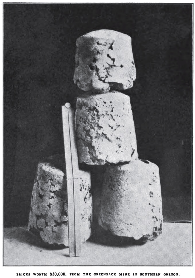 Southern Oregon is peculiarly adapted to hydraulic placer mining. Every stream and gulch contains gold. Even in the valleys, where the soil is rich, there is gold, and the farmer and the miner work side by side. Owing to the abundance of the auriferous gold deposits, the many streams, the mild winters, the heavy rains, the non-restricting mining laws, the placer miner has many advantages in this section that are denied him elsewhere. Beds of ancient channels are found along the rivers and streams. The gravel of these old diggings comprise the diggings of the placer mines. These channels lie on bedrock to a depth of from eight to two hundred feet. On the bottom, next the bedrock, are the boulders, the nuggets and coarse gold. Above this is the finer gravel and pipe clays, lying in strata of blue and gray. Still above this is the layer, or capping of red clay, which carries its values in fine or flour gold. 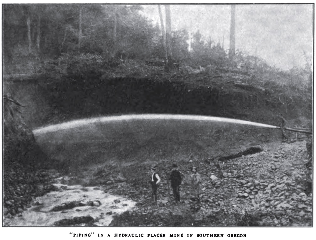 As the amount of mining done is dependent upon the water supply--other things being equal--that miner who has the best supply for the longest season is owner of the best property. The hydraulic placer season is covered only by the wet or winter months, beginning in November and closing in April or May. A few of the larger properties operate through June and July. The dry season is utilized in making the annual cleanup, and in overhauling and repairing the ditches, flumes and pipe lines. Once started, the giants never cease their roar from the beginning to the end of the season. Night and day they hurl their avalanche, ceasing only when the north wind puffs warm, and the snows disappear from the peaks of the Cascades. One giant washes down more gravel in an hour than the pioneer, with his shovel and rocker, could do in weeks. It costs from one and one-half to five cents a cubic yard to mine a mountain by the hydraulic method in southern Oregon--after the first cost of equipping the property. It is usually considered that a giant mines $100 in gold each day it is operated. This is a very conservative estimate, as there are a number of mines that uncover $200 every day with each giant. A crew of only fifteen men is sufficient for both the day and night shifts of the largest properties. The mines produce from $6,000 to $60,000 each for a season, the size of the cleanup depending upon the number of giants employed, and upon the general capacity of the property, as well as upon the value of the ground. But on an average, the placer channels of southern Oregon carry from ten to thirty cents a cubic yard, thus leaving a good margin of profit. Placer mining, like any business, must be conducted on business principles to be successful, and in southern Oregon the operator has everything in his favor. But all southern Oregon's gold comes not alone from placer channels. And while this section of the state has some of the richest quartz mines of the West, ledge mining is in its infancy here. Because of the great amount of gold on the surface, the genuine prospector was long in coming. At present there are over one hundred and fifty quartz mines being operated or developed here and more than thrice that number of claims and prospects. Where there is such vast acreage of placer ground and surface diggings, there must also be deep-setting ledges whence the gold of the wash channels came. So the development and operation of recent years has demonstrated that southern Oregon has vast bodies of free-milling and base ore in its mineralized mountains. There are some twenty-five mines equipped with mills and reduction plants in southern Oregon. These mills represent a total of two hundred stamps. Many of them increased their batteries this season, because of the excellent showing of the ore bodies. The Greenback, with its two mills, one of ten and the other forty stamps, is the largest southern Oregon quartz property. Three hundred and fifty people, supported entirely by the mine, live in the town of Greenback, on Grave Creek. Granite Hill mine and camp, with its population of two hundred, is another of the larger mines of this district, and is located near Grants Pass. Other camps and flourishing mining centers are Gold Hill, Takilma, Galice and Jacksonville. 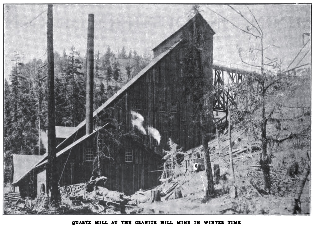 The Greenback, Granite Hill, Opp, Braden, Homestake and Bill Nye mines all use electric power, generated by the power dams on Rogue River. There are already more than three hundred miles of electric wire power line in southern Oregon, and more lines are being strung. Electricity is not only more convenient, but is a far more economical power than steam. It is more regular, is no trouble to generate, is always ready, and can be conveyed to the deepest levels of a mine without loss, or without causing the great discomfort of extreme and smothering heat. This proves a decided advantage in all properties that require much pumping from the lower levels, to prevent flooding. The use of electricity for power also saves the fine timber on the mining claims, leaving it to a better purpose than that of being cut into short lengths for cordwood. Thousands of acres of rich dredging ground on the Applegate, Illinois and Rogue rivers have been bonded by the Oroville and other prominent dredging companies of the West for development and operation. On Foots Creek, a tributary to the Rogue, the dredger of Champlin & Co. has been successfully operating for the past three years. This dredger is operated by electricity, and is one of the largest and best of all the great fleet of gold ships of the Pacific Coast. It has a capacity of two thousand yards daily, and has ground enough to keep busy, day and night, for twenty years. This dredger makes a weekly cleanup of from $1,500 to $3,000. Southern Oregon has a rich and extensive copper belt, located at the lower end of Josephine County in the Waldo district. The great Iron Mountain and Siskiyou copper sections of Northern California, only a few miles farther south, are a part of this same belt. This copper area is twenty-five miles wide by sixty miles long, and embraces a half score well-developed properties. At Takilma, near Waldo, is located the Takilma Smelter, Oregon's only copper reduction plant. It was built and is operated by the Takilma Smelting Company of Colorado, and the Waldo Smelting and Mining Company of California, both companies owning properties in the district. The smelter has a capacity of two hundred tons daily. During the summer season, the Takilma Company employs a freight train of one hundred and twenty-five horses and mules to haul over the forty-five miles of mountain road from the smelter to Grants Pass, and to carry out coke for the operation of the plant. Large crews are employed in the Queen of Bronze, Cowboy and Lyttle mines, the properties that supply the smelter with ore. After the present summer, the method of hauling matte and coke by wagon will be a thing past, as a railroad is being built, connecting the smelter with the Southern Pacific at Grants Pass. Sunset Magazine, August 1906, page 139 HOW TO SAVE GOLD
Dennis Stovall in Ores and Metals:
Millions of dollars have been lost to the placer miners of western
America during the past fifty years because of inadequate or
incorrectly constructed riffles in the sluices. Only in recent years
have placer miners come to a full understanding of the importance of
having the right kind of riffle installed in their sluices. Formerly
the whole object of the surface diggers was to move the dirt; to tear
down the gravel blindly, thinking the gold would take care of itself.
The dredger, with its excellent system of riffles and modern
gold-saving devices, has been the chief factor in leading placer miners
to see and understand the importance of this feature of surface mining.
In fact the highest percent of gold is saved by the dredger; the
old-time rocker is second on the list; the ground sluice is third, and
the hydraulic mine is fourth. Though the hydraulic mine moves much more
gravel than all the others, it saves less gold, the loss being due
solely to inadequate riffles.Placer Miners Lose Through Faulty Obstruction of Riffles. THE BEST KIND OF RIFFLES Old Miner Says to Give Water in Sluice a Free Flow. The trouble comes from the too generally accepted notion that the old-time methods are all right, and that the Hungarian, the block, the cross and all other riffles cannot be improved upon. The writer has made a special study of riffles used in various Pacific Coast placer mines and has come to the conclusion that from thirty to forty percent of the total gold values of the diggings are lost because of poor riffles. Miners spend too much of their time and money in making the mining end of their mine bigger and better, and fail to look out for the saving end. The ditches, pipe line and giants are the best that money can buy or scientific skill produce, while the riffles and sluices are the same type as that employed in the pioneer diggings of half a century ago. It is a plain case of "saving at the bung but wasting at the spigot." An investigation was made this season into the cause for loss suffered in the attempted saving of gold in one of the largest hydraulic mines of Southern Oregon. Though this property has been in operation for fifty years, the owner has long realized that his returns were not what they should be. He had used the block riffle, the steel riffle, Hungarian and all other of the accepted forms, but found gold in the dump from all of them. No matter how long the sluices were strung out, the fine gold and the platinum went over, and not a little of the coarser pieces. This miner examined the deeper holes along the course of the bedrock race, leading to the sluices, and always found gold below and above, but never in the hole. Scores of these holes were cleaned out annually, with hope of finding gold in them, but they were always bare. This set him to thinking, and he came to the very reasonable conclusion that his cross and block riffles were simply a series of holes, into which the water boiled, giving the gold no chance to settle. So he devised a riffle that eliminated boiling, and he now saves practically all of the gold, coarse and fine, as well as platinum. This go|d and platinum-saving riffle is built of two-by-four timbers, the scantling being cut of standard length, or in twelve-foot sections, and set up edgewise in each section of sluice. There is a two-inch space between each scantling, and the top edge is beveled and laid with a three-eighths-inch strap iron. This iron strap is a little wider than the scantling, extending over on each side. Most miners would condemn this riffle on sight by declaring that it offers no resistance to the gold. What they should say is that it offers no resistance to the water, and this very fact covers the excellence of the riffle. The theory that a riffle to be good must offer resistance to the water is wrong. The water flows over this riffle smoothly and without boiling, and the gold and platinum particles, no matter how light or fine, have abundant opportunity to settle. Rocks that are small enough to drop down and lodge will soon fill the apertures between the scantling and below the straps, but this only adds to the efficiency of a riffle, and makes it more like the natural riffle of the bedrock race, which riffle every miner knows is the best possible riffle for saving gold. This is a riffle that every placer miner can well adopt. It is easily and cheaply made, is far less troublesome than the block cross riffle and pays for itself many times over in one season, by the greater percentage of gold that it saves. Elk City Mining News, Elk City, Idaho, October 13, 1906, page 1 The Art of Prospecting in
Southern Oregon
Two professional prospectors came here from the state of Washington,
entered the Williams Creek district, and cleaned up $30,000 in three
weeks. The ground on which these men did their work had been prospected
time and again; it is one of the oldest mining districts in Oregon. But
these men found gold where others had failed; it was because they knew
their business.Written for the Northwest Mining Journal by Dennis H. Stovall, Grants Pass, Ore. The two boys have only sunk a few shallow prospect holes, and the gold they have taken out is only the rich stuff contained in the oxidized portion of the vein. They have really struck a system of quartz veins, and the conjunction of these ledges forms the rich bunches from which the main bulk of the gold is taken. Besides the large amount of metal already taken from the discovery, all of which has been mortared out by hand, there yet remains fully $75,000 in sight. The Southern Oregon Mining District, which extends from the California line on the south to the Calapooia Mountains on the north, and from the foothills of the Cascades on the east to the Pacific Ocean on the west, covering an area of 5,000 square miles. Much of this country is quite mountainous, some of its summits reaching 5,000 feet above sea level. But between these spurs and ranges rest beautiful valleys and vales, all abundantly watered by the numerous rivers and creeks that are fed by the everlasting snows of the higher levels. Gold is found everywhere in the district. Here the farmer and the miner work side by side. Though some of the districts have been scratched over for the past sixty years, there still remain many sections that have not been prospected at all. The geological formations are chiefly metamorphic slate and quartzite in the southern part and slate, serpentine and conglomerate in the north. Denudation has been very extensive in all the region, cutting canyons 2,000 feet deep and carving out valleys and mountains from what appears to have been an elevated plateau. This is an easy country to prospect. The winters are mild, and the abundance of water and timber makes it possible for the gold-hunter to remain on the trail at all times of the year. The method most used by prospectors in this district is that of "tracing." When a favorable spot is found, the prospector halts and strikes camp beside a stream. He follows the stream and pans the dirt, washing each pan down carefully and scanning the remaining residue for colors of gold. If a little string of yellow flows in the corner of the pan, close behind the black sand, the prospector smiles. The little string of yellow is colors of gold, and the black sand to which it closely clings is its inseparable companion. He pans again, near about, then pans again, and if the colors grow better with each pan, the prospector smiles yet more happily, for then he knows he is on a trace, to follow which correctly will lead him to the treasure. Frequently during the panning the prospector pours the minute dust-like particles into the depths of his palm and examines them critically. He knows at once whether all of those colors came from the same source. No two colors of gold are alike to him. And that is why the old-timers say "prospecting is an art"--it requires years to learn some of these things. When a ledge is struck, or the outcrop of a ledge, the miner's first work is to ascertain its value. He will dig an open cut to a depth of three or four feet, and chip fragments of quartz from the vein. These are as finely powdered as possible and panned out. It frequently happens that the ledge is some distance from water, and the powdered quartz must be carried through the undergrowth and over the hills, a mile or more, to the nearest stream. The amount of colors left in the residue will indicate the quantity of free gold carried in the vein. But it will do no more than that. It will not tell the whole story. Sometimes very rich quartz will not pan at all, the values being hidden in rebellious sulphides. To ascertain the value of base quartz, and where there is no assay office within a radius of many miles, the prospector becomes at once his own assayer. He pulverizes the quartz into a dust, and adds to it one-third as much gunpowder as there is pulverized ore. The whole is then mixed with water and made a thick paste. He shapes it into the form of a cone, and places it on a flat rock to dry. When dry the point of the cone is fired with a match, and the mass sputters and burns away till there is naught left but a small black and charred metallic button. A little polishing and scraping will satisfy the prospector as to the identity of the metal. Northwest Mining Journal, August 1908, page 3 Gold Mining in Southern Oregon
By Arthur M. Geary
The miner is again a factor in the material progress
of Southern Oregon. The prospector, with his peculiar glint of eye and
bulging pockets, is often seen on the streets of Medford and Ashland,
where he comes for supplies or in search of financial backing in the
promulgation of his projects. But boding more towards the development
of the mineral wealth of the region than the presence of the
prospector, who has always been somewhat in evidence in Southern
Oregon,
the eastern capitalist has become interested. Mining promoters whisper
the names of noted mining men who are backing them in development of
their properties. R. A. Towne and other New York capitalists have
invested a million dollars in the improvement of the Blue Ledge copper
mine, situated 35 miles from Medford. As soon as Hill builds his
proposed railroad lines to tap the different districts, large
quantities of eastern money will undoubtedly be spent in the
development of other properties as well.
The initiated know that Southern Oregon and the tributary district of Northern California have had a mining history. Men are yet alive who witnessed and took part in the mad struggle for gold which ensued in the '50s. The fact that on New Year's Day, 1852, the population of the Rogue River Valley numbered 28, and four months later totaled 1000, bears eloquent testimony of the genuineness of the gold rush in Southern Oregon. That $30,000,000 of gold was sent out of Jackson County between 1851 and 1883 testifies that the gold discovery in Southern Oregon was no false Eldorado. The mining of gold was a tremendous factor in the rapid settlement and development of Southern Oregon. Previous to 1852 trappers on fur-hunting expeditions and groups of travelers passing between California and Southern Oregon brought tales to the settlements of the meadows where grass grew as high as a mule's back, of the seeming fertility of soil, and of the superb climate. But the fear of the thieving Rogue River, Shasta and Klamath Indians, with their occasional massacre of the unwary traveler, struck terror into the hearts of the immigrants and caused them to choose homes in the safer precincts of the Willamette Valley. In the spring of 1851 there were only three habitations of white men in the Rogue River Valley. These were at Perkins', Long's and Evans' ferries on the Rogue River--Perkins' ferry being near the present site of Grants Pass. In the summer of '51 Governor Gaines, aroused to action by the reports of numerous murders and robberies committed by the Southern Oregon Indians, obtained federal aid in punishing them. United States soldiers and volunteers waged a short but effective campaign against the Rogue River chiefs known as Sam and Joe. In midsummer, following the campaign, a treaty was drawn, after which a few men took up donation claims in the region. [Geary seems here to be confabulating memories of the unwritten 1850 treaty with those of the 1853 Rogue River Indian War.] The first to arrive was Judge Alonzo A. Skinner, who had been appointed Indian Agent. He took a claim near Table Rock. [Other sources place his home between the sites of Central Point and Medford.] The Rogue River Valley, however, was too isolated to invite settlement for agricultural purposes. It necessitated the call of gold to attract white men into this dangerous and lonely valley. The discoverers of gold in Southern Oregon were James Clugage and Pool. During the winter of 1851-52 they had driven their string of mules up Jackson Creek to fatten and condition them for packing in the spring. These men chose Jackson Creek for their pasture ground because it was off the beaten track. At this time Californians from Yreka were scouring the country in search of horse thieves, and it was safer for two men with a string of mules to be encamped in a secluded spot, as pursuers were nearly as lawless as [the] pursued. While encamped on Jackson Creek early in January 1852, these men discovered gold shimmering in the gravel of the creek bottom. The news of the strike spread rapidly to the partly exhausted gold fields of Northern California, and hordes of miners left their diggings to try their luck in New Eldorado. A steady stream of men poured into the Rogue River Valley, and spreading out from Jackson Creek, scattered throughout the surrounding hills. The inrush of people continued during 1853. In that year 150 wagons of immigrants, containing 400 men, 120 women and 170 children, and 2600 cattle, came north from California, and as many more arrived via Northern Oregon. The majority of the arrivals from California were miners, pure and simple, while those who came from the Willamette Valley saw possibilities in agriculture as well as in mining. Many of the Willamette Valley travelers devoted themselves wholly to farming, and found a lucrative market for their wheat and vegetables among the miners. The men who hurried from the California gold fields were of all nationalities and often of a lawless sort. After the first discovery of gold, fortunes were accumulated rapidly. Among the lucky ones was James Skinner, nephew of Judge A. A. Skinner, who mined a fortune within a week. "Old Man" Shively was another fortunate one. He gathered $50,000 worth of gold dust and left for civilization, heavily armed, determined to defend the fortune which he had acquired after a long life of prospecting. Rich strikes were reported on every hand. One hundred men were soon at work with rockers at Big Bar. Gravel rich in gold was found at the Cameron place on the Applegate. Forest Creek and Foots Creek were other districts where heavy-producing placers were soon being worked. The best evidence as to the amount of gold actually given up by mother earth is that furnished by C. C. Beekman, pioneer banker of Southern Oregon, who operated an express business between Yreka and Jacksonville during the early days. He carried $10,000,000 worth of gold dust out of Jackson County between 1856 and 1860, he believes, and an equal amount found other ways of exit. After 1856 the output of the mines decreased annually. Before 1860 the average amount mined every year was estimated at $1,250,000. In 1860 the mines produced $1,150,000, in 1870 two-thirds of that sum, and in 1880 less than $250,000. Between 1856 and 1880 there were 5438 mining locations filed upon. Of this number 16 were copper, one was tin, 124 were cinnabar (sulphide of mercury), and the rest gold and silver. In 1855 came Jackson County's maximum gold prosperity. That year it was said that gold dust to the value of $3,000,000 was mined. At that time Jackson County was the wealthiest and the most populous in Oregon, Multnomah County included. Jacksonville, whose essential claims upon life today are the rugged beauty of its scenery and that it is the county seat, was then in the height of its prosperity, with multitudinous saloons, and gambling dens galore. 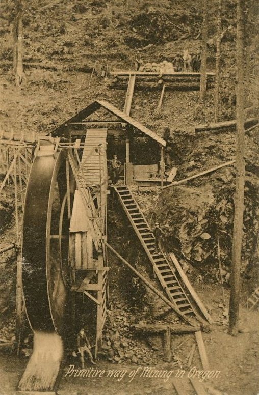 A water-powered arrastra at an unidentified Oregon mine, circa 1907 In January 1860, "Emigrant" Graham discovered the Gold Hill ledge, which was the first important quartz gold discovery. The float rock on the surface yielded astounding returns to Graham and his associates. The strike was the signal for a new outburst of mining enthusiasm. The surrounding hills were quickly staked out, and the outlying districts teemed with prospectors. Jacksonville, which of late years had not been so lively, prepared for the reversal of happy and prosperous times. Two mule-power arrastras were placed on the original claim, and armed men guarded while they were operated. It is said that every Saturday night a cleanup of 1000 ounces of gold was divided among the five owners. Henry Klippel, known as the father of quartz mining in Southern Oregon, bought an interest in the mine. Klippel, in company with McLoughlin and Williams, finally sent to San Francisco for a 12-stamp steam mill, taking a contract to work the quartz for $8 a ton. The machinery, including boiler and mortars, was shipped to Scottsburg and thence carried by pack train to Gold Hill. The freight charges on the mill amounted to $2600. With this, the first steam stamp mill of Southern Oregon, in operation, the owners felt that fortune would smile upon them indeed. One hundred tons of refuse quartz, which had been considered too poor for the arrastras, were first run through the mill, yielding $100 to the ton, but here the good luck ended. The next body of ore to be worked yielded $3 a ton, and the next $2.80. When all hope of success at the Gold Hill quartz mines was finally abandoned by the owners of the mill, the machinery was converted into a saw mill on Big Butte Creek. Henry Klippel estimated that the total output was $150,000. The Blackwell, Jewett, Swinden, McDonough, Schumpf, Johnson, Lyon, Peebler, Holman and Fowler quartz ledges were worked at this time with varying degrees of success. The Steamboat lode was perhaps the most productive of these quartz ledges. During 1860 and 1861 it yielded $280,000. These two years included the early quartz mining history of Southern Oregon. No great successes were gained after that period. The gold was too scattered in pockets, and methods were too primitive then to give lasting success to quartz mining, and it was abandoned for a number of years. Of late, renewed interest, however, has been taken in quartz mining. There are 52 quartz mines now in operation or in stages of development in the district, embracing Southern Oregon and Northern California. That many of the miners who rushed into Jackson County in the early '50s amassed fortunes the amount of gold sent out of the country bears witness, but that many, especially after the best strikes had been made, expended their energy in vain the thousands of little excavations scattered throughout the country and found scarring every hillside give evidence. As the supply of gold which could be mined according to the primitive methods of the day gave out, most of the miners went to other fields. The discovery of gold in Idaho caused a large exodus of miners [whose] absence was felt keenly for a time by the farmers and tradesmen whose customers they had been. The cattlemen, who with their herds inhabited the grassy plains of Klamath County, soon took the place of the miners who had departed, and the stagnation due to [the] oversupplied market was relieved. One race of foreigners which prospered where white men failed was the Chinese. Chinamen swarmed into the country, taking possession of the worn-out placers. By 1859 the yellow face of the Mongolian was everywhere in evidence. They were peaceful and law-abiding, but notwithstanding the usual racial prejudice sprang up among the disaffected miners. It was charged that the Chinamen were mining American gold and taking it to the Flowery Kingdom. As the Celestials were law-abiding and absolutely refused to quarrel, there was no pretext for exterminating them or driving them from the country, as there was in the case of the redskins. Finally, in 1859 the California method of treating them was adopted. A tax of $2 a month for miners and $50 a month for merchants was levied upon them under the caption of "Foreigners' Tax." [Oregon's "poll tax" on Chinese residents was instituted in 1857 by the state legislature. In 1859 it was extended to Hawaiians, in 1862 to "Negroes and mulattoes."] Even these stringent measures had but mediocre success in stemming the tide of Chinese immigration, as the tax was difficult to collect. The Chinese were satisfied if their mines would pay wages, and in their slow but sure way amassed what was to them a fortune and left for their native country. Gradually Yellow "John" has quit this field of enterprise, and few Chinese are seen today in the Rogue River Valley. Placer mining in Southern Oregon has gone through much the same stages as in California. First the Mexican batea, or an ordinary cone-shaped pan, was used by the miners. Then the rocker or cradle came into use. After this came the tom, an apparatus with cross riffles which permitted the play of a continual stream of water. Then sluice boxes were built across the claims where there was sufficient water. By this method miners could shovel gold-bearing gravel into running water from both sides. The gold in the gravel was caught on the quicksilver plates at the riffles. 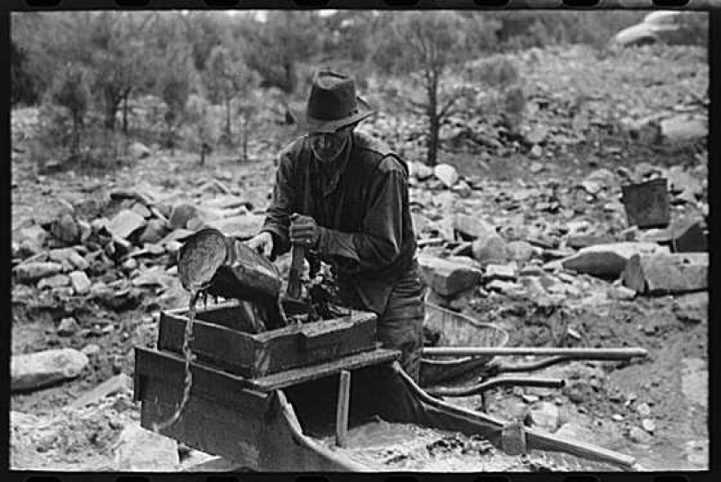 A rocker in use in New Mexico, 1903. 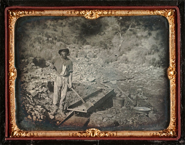 A long tom circa 1852, California. 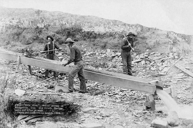 A sluice box in the Dakota Territory, 1889. 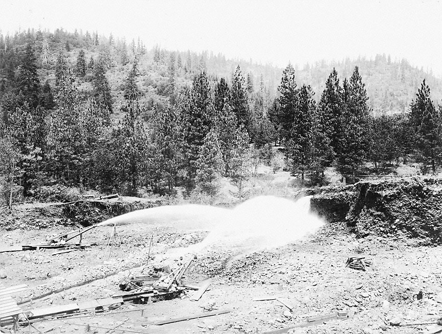 Hydraulic mining at the Sterling Mine in Jackson County, circa 1900 The greatest handicap to hydraulic mining in Southern Oregon has been the scarcity of water. Most of the mines can only be worked during the rainy season, as the majority of the smaller streams dry up in the summer. Projects have been proposed several times to bring water 50 or 70 miles to the mines from one or other of the large streams, but as yet none of them has materialized. The Jacksonville Sentinel, in 1859, referred to the possibilities of hydraulic power contained in the opening of artesian wells. The paper went on [to] show that the Rogue River made the proper bend at a high altitude and that the lower strata of ground were of the proper gravelly nature to ensure the presence of these artesian wells. However, only two artesian wells have been found. These are in the Talent orchard, where their limited flow of sparkling aqua is used in stimulating the growth of the celebrated Rogue River Valley [omission] bring a harvest as truly golden as placer mining. At present the Rogue River Canal Company is preparing to build 200 miles of ditches from the headwaters of Big Butte Creek. The water is for irrigating purposes, but there is no cause to prevent some of the flow being used in mining, as the highest ditch will run well back into the hills where the placers are situated. 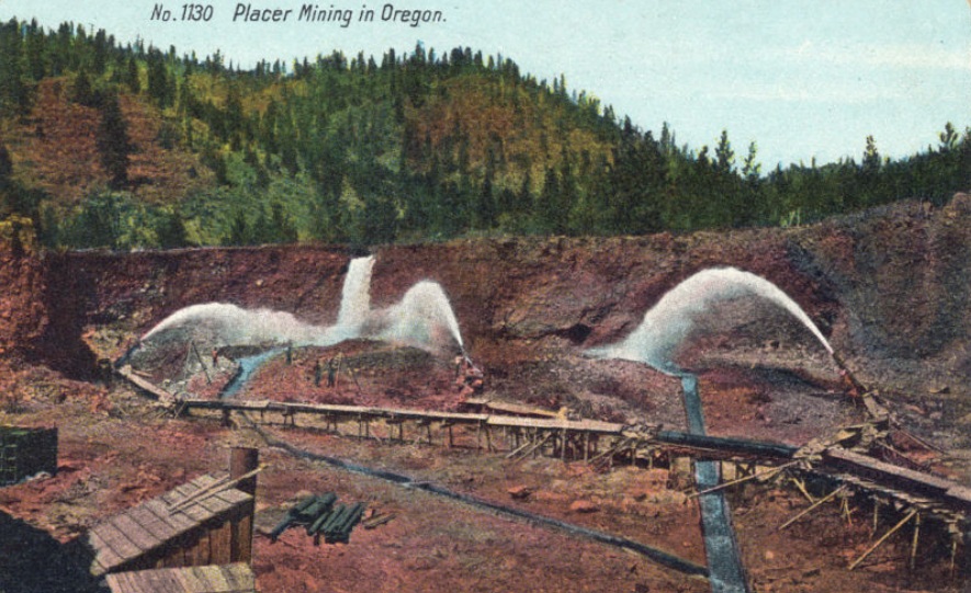 Sterling Mine, circa 1905 There are many signs of awakening interest in mining throughout the coast. California, for the first time since 1897, has gained first place from Colorado as the foremost gold-producing state in the Union. The increased production of gold in California has been due to the development of dredge mining. Operations of this character are being started on Foots Creek in the [western] part of Jackson County. The possibilities of dredge mining in Southern Oregon, where many streams with rich channels abound, are just now beginning to be investigated. As a reaction from concentration of energy upon the exploitation of Oregon's horticulture possibilities, great effort is now being made toward the advertisement and development of Oregon's mineral wealth. Sumpter this year held its first mining congress--representative mining men coming from all parts of the district, which extends into Idaho. A meeting of miners of the Southern Oregon and Northern California districts has been called at Ashland for January 17. This getting together of mining men will mean much for the development of the mines of Oregon. The state miners' association, with L. D. Mahone as secretary, is showing unexpected life and is becoming a strong factor in putting mining upon a practical business basis. Gold is by no means the only mineral to be found in Southern Oregon. Quicksilver, coal and silver as well as copper mines are being developed. W. H. Jackson is developing the Mammoth quicksilver mine on the Rogue River, and cinnabar properties are also being opened on Evans Creek. A large body of coal has been found within five miles of Medford and is being sold for fuel. The coal will be of special value as fuel for the smelters of the Blue Ledge copper mines when railroad communications are built. Undeveloped deposits of lead, salt, coal and limestone exist in this region. Limestone for years was burned in kilns situated on Jackson Creek. Marble and granite quarries are being operated at Tolo and near Medford. The crushers at Tolo are able to turn out 50 carloads of crushed granite for use on roads every day when in full operation. This plant is equipped with air compressors, air drills and grinding and polishing machinery to furnish granite for building purposes and monumental work. Electric power generated at Gold Ray Dam, on the Rogue River, is used in this quarry. The tremendous water power now running unharnessed in the Rogue River, Big Butte Creek and other smaller streams will furnish all the power needed for the development of mining and quarrying for centuries to come. The mineral springs which are found scattered through Southern Oregon are another natural resource furnished by nature. Extensive bottling works are being operated at Wagner, Colestin and Shasta springs. 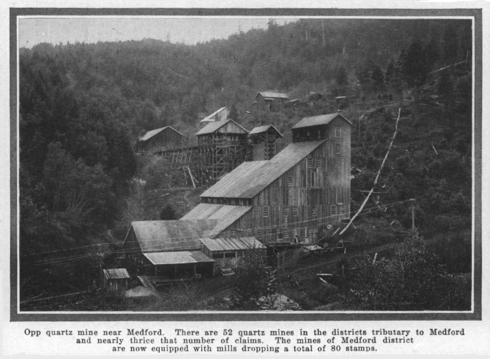 Opp Mine, 1909 There is no rational ground for believing that the miners of the '50s could have uncovered so much treasure as they did and not leave untold wealth which their primitive methods and tools could not reach. Medford Mail Tribune, February
5, 1911, page B1 This
article was originally printed in the Sunday Oregonian of January 22, 1911, page 18.
No one has ever been able to find definite sources for the enormous amount of free gold that is found in the placer mines along the Rogue. Of course some quartz ledges have been located and mined and in one instance, that of the Gold Bug mine, enormous quantities of gold have been taken out. It is estimated that $800,000.00 in gold has been taken from this one mine. There are several other successful quartz mines that should be mentioned, namely, the Oriole, the Golden Wedge, the Green Back, the Copper Stain and the Benton mines. But quartz mining, as we all know, is an expensive proposition. Machinery must be used to crush the ore; various means used to separate the gold-bearing ore from the waste; then cyanide used to precipitate the gold, and so on, until the gold is free and marketable. There are two distinct classes of placer mines, those in the bars along the present bed of the river and those in the old channel. The old channel mines show forth more gold and coarser, because the heavier gold was first washed down the river. Where the old channel is bare rock and loose gravel there is no use in mining; but the rich mines are found where landslides have occurred and covered deep these old river beds. In this way the gold was imprisoned and of a necessity forced to remain till the placer miner takes it forth. These landslides were enormous, in many cases filling up the entire river bed and forcing the river to seek a new course. Great rocks, weighing tons, were tossed down the mountainsides as if they were pebbles, and the miner must contend with these great stones. Dynamite must be used to break them to pieces and a derrick erected to get these pieces out of the way. Many of these boulders are of the hardest composition and an ordinary blast of dynamite has little or no effect upon them. I was told by one miner that he had used thirty sticks of giant powder on one boulder. Water is the chief necessity in placer mining. There are known to be several rich deposits of gold along the Rogue, but as no water is available it cannot be mined profitably. True, water could be carried miles, but a man has to consider what his returns will be. Can he afford to invest $20,000 in order to get out $10,000? This is the proposition that confronts them in one place that I know of. That is the one great trouble with mining. A miner knows he has gold and a company is formed. Money is spent and a few improvements are made. The miner then sees the absolute necessity of additional pipe lines, dams, sluices, derricks, etc. before he can mine satisfactorily. Before he realizes it, an enormous sum has been expended. Stockholders wonder why no dividends are forthcoming. They begin to think that they have been defrauded. An investigation is made. It is found that there is gold in the mine. No doubt about that. But more money had to be used to extract that gold than there was gold in the mine. And so, many have lost faith in gold mines and their exploitation. Few mines are conducted by practical engineers. If all mines were crosscut and a careful estimate made of the mine and what its probable output would be, then one could calculate on the amount to be invested and what would be the cheapest and most practical way to extract the gold. If the names would mean anything to the reader, I could cite mine after mine along Rogue River and elsewhere, from which profits have not and never will be made. It has been said that the man who can find the way to extract placer gold without going to great expense, can make money, but otherwise he had better leave placer mining alone. One of the largest placer mines along the Rogue is the Old Channel mine. It is said they took out $25,000 one year. But their equipment was so expensive and the difficulties encountered in mining were so great, that it has not proven a profitable investment. Once in a while someone will stumble on a pocket of gold and he is considered very lucky indeed, but the man who toils at his little mine, year in and year out, has usually as much at the end of his toiling as at the beginning. It is no trouble to find "colors" along Rogue River. One can take a pan and scrape together some moss and sand from the bedrock and after panning will find from one to fifty specks of gold dust. But, when one gets this, what has he? It would take thousands of these specks to weigh a few grains. Anyone wanting merely to get gold colors, in order to say he has panned out gold, should certainly come to Rogue River. It is estimated that over a million dollars in gold washes down the Rogue annually and is swept into the sea. At the mouth of Rogue River is the county seat of Curry County, Gold Beach. It was named from its golden sands. Gold is found in the sand there and three or four men manage to eke out an existence by "rocking" gold from the sand. A rocker is a wooden box of two pieces, patterned after an old-fashioned cradle. The top part is removable; a sheet of iron perforated with half-inch holes is placed in this top part; underneath are two trays covered with canvas to catch the gold and sand that filters through the metal above. The material to be washed is placed in the top on the perforated metal, and water poured on this; at the same time a rocking motion is given to the rocker and the gold filters through, leaving the waste in the top box. This is dumped. After a half hour or so the inner trays will be full of sand and gold. This is put into pans and washed until nothing remains but black sand and gold. This black sand is metallic and more or less iron, so remains with the heavy gold. I presume you have wondered how the gold was collected. In the mines where the flumes and sluices are used, on the day of the "cleanup," pans are used to wash out the black sand and gold, just as with the rocker. Quicksilver is put into the vessel containing the black sand and gold and quickly forms an amalgam with the gold. After all the gold has been amalgamated in this way the resultant metal is smelted and the mercury goes off in fumes, leaving the pure gold. This gold has a curious sponge-like appearance, and it is in this form that it is always referred to by assayists and others as sponge gold. Rogue River gold is valued at four cents a grain, or a little over $18 an ounce. Someone has asked how the gold here was marketed. It is used the same as money in paying bills and wages, and any bank in the West will receive the gold at full value. I would like to give you a little idea of the general appearance of a placer mine and will take as an example the Francis mine here at Horse Shoe Bend. It is a gravel bar, partially old channel, of perhaps five or six acres in extent. From eight to ten feet of gravel and boulders have been deposited on the bedrock, and the gold is mixed all through this deposit. In making an opening into a bar for a mine, it is best to take the lower end, just below the rapids. An excavation is then made back into the bar and it becomes necessary to wash all the gravel and boulders. As I have stated before, water is brought to the mines in most cases a great distance and at an enormous expense. Here at Horse Shoe Bend, on the side of the river where the mine is located, was dug a ditch, and in many places a flume had to be constructed of wood, at least a half mile in extent, bringing to the mine water from two mountain creeks. This water is used for the "giant," which is the name given the huge nozzle through which the water is forced against the material to be washed. One can thus realize what an enormous pressure is acquired. But there must be another stream of water for the "elevator." The elevator, as its name implies, is an apparatus constructed so as to elevate, by water pressure, the material washed from the sides of the mine and from which the gold is to be taken. Enormous water power must be had for this elevator. In the case of the Horse Shoe Bend mine, water is brought from Jenny Creek, a mile away, on the opposite aide of the river from the mine. A ditch had to be dug the entire distance; flumes had to be constructed in several places; then, when all this was done, a way must be made to get that water across the river. It was necessary to construct a suspension bridge high enough to escape all the extreme rises of the river in the winter season. This bridge was completed last year. It is 275 feet long. about twenty-five feet above the water, and has a carrying capacity of ten tons. The water is conveyed over the bridge in cast iron pipes and then on to the mine. This is the source of supply for the elevator. The boxes in which the gold is collected are called sluice boxes There are three kinds of sluice boxes, the "block," the "pole" and the "Hungarian riffle." Each miner has his preference, though the pole is universally liked. The block method, as is implied in its name, is merely great blocks of wood placed side by side in the box, so that when water flows over this, carrying the sand and gravel, the gold, being heavier, will settle between the blocks. In the pole sluice box, stripped fir trees are placed lengthwise and the gold drops between the poles. In the Hungarian riffle, strips of wood are placed crosswise in the sluice box. Two or three of these boxes are placed on the nearer side of the elevator, and on the farther side a sufficient number to carry the waste out into the river. The giant nozzle plays against the sides of the excavation and washes the material to the bottom of the mine into the first sluices, where, caught in the current of water hurrying towards the elevator, it is hurled through this, the gold washed from the stones, and then collects as it passes on down through the various sluice boxes. A "cleanup" is held every month or so and then the rocker and pan, which I described before, are used. Several good mines are being exploited along modern lines. That is, a careful estimate is being made of the amount they are supposed to contain and an efficient and practical way developed by which to extract the gold. In such a mine one need not fear to venture an investment. But let us all beware of the mine of which we know nothing except the argument of a prospectus or the futile promises of a promoter. John G. Gerwick, "Placer Mining Along Rogue River," Woodstown Monitor-Register, Woodstown, New Jersey, July 19, 1912, page 3 Last revised November 22, 2025 |
|